This fun interactive map by William B. Davis shows you the ten closest…
Maps
Intuitive to look at spatial patterns and great for distributing geographic data.
-
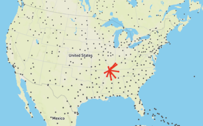
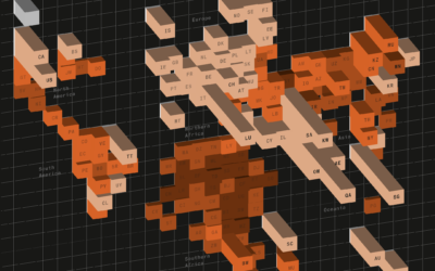
Map of closest airports everywhere
-
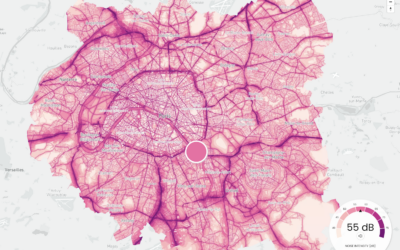
Maps of noise
Karim Douïeb, in collaboration with Possible, mapped noise in Paris, New York, and…
-
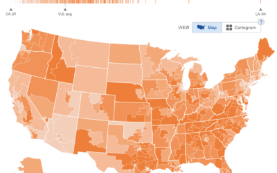
Interest levels for political issues mapped
To estimate public interest in the many political issues across the United States,…
-
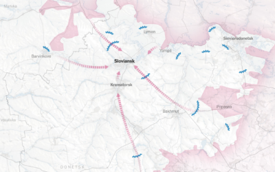
Shrinking war mapped
The war in Ukraine continues, but the scale and objects appear to have…
-
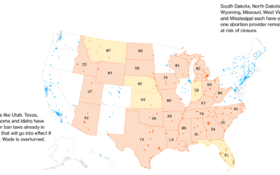
Map of clinics at risk of closure
If Roe v. Wade is overturned, over 200 clinics would potentially have to…
-
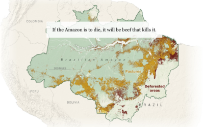
Beef and the rainforest
People like beef. To raise more cattle, companies need more land. Sometimes to…
-
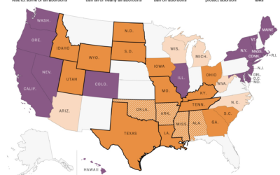
State policy if Roe v. Wade were overturned
If Roe v. Wade were overturned, abortion policies would change in many states.…
-
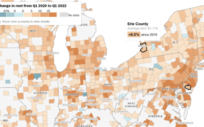
How much rent increased where you live
Rent increased pretty much everywhere in the United States over the past year.…
-
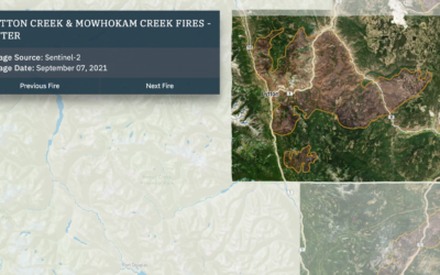
Wildfires and floods, a geographic before and after
In 2021, a large portion of North America was stuck in a heat…
-
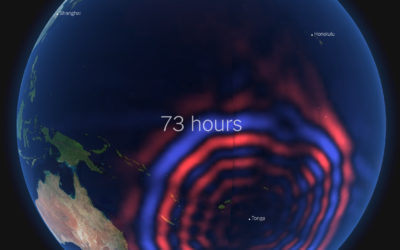
Tonga shockwave around the world
Earlier this year, an underwater volcano erupted in the island nation of Tonga.…
-
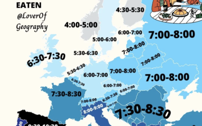
When people eat dinner in Europe
This map by @loverofgeography shows the usual dinner times for countries in Europe.…
-
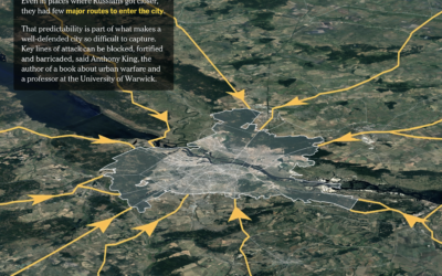
Ukraine’s defense in Kyiv
The New York Times shows how Russia has tried to take over and…
-
Pollution by the rich versus poor
Based on estimates from the World Inequality Lab, Bloomberg shows how wealthier individuals’…
-
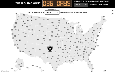
Days since record-high temperatures
Here’s a fun/alarming weather map from The Pudding. Using data from the Applied…
-
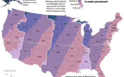
Sunrise times with permanent Day Light Saving
Changing the clocks twice a year can be a hassle, so some people…
-
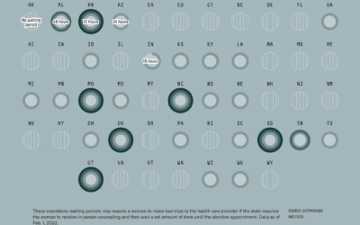
Abortion restrictions in the U.S. mapped
For FiveThirtyEight, Anna Wiederkehr and Amelia Thomson-DeVeaux, with illustrations by Nicole Rifkin, delve…
-
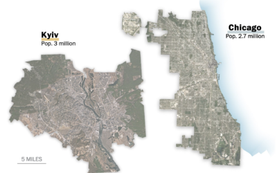
Scale of Ukrainian cities
When you look inside the cities around the world, you will often find…
-
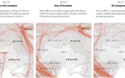
Empty Ukrainian airspace
As you would imagine, Ukrainian airspace looks empty right now. Reuters mapped flights…
Recently for Members
Second Edition
 Visualize This: The FlowingData Guide to Design, Visualization, and Statistics (2nd Edition)
 Visualize This: The FlowingData Guide to Design, Visualization, and Statistics (2nd Edition)
New tools, refined process.
Browse by Chart Type See All →


