Rachael Dottle, Laura Bliss and Pablo Robles for Bloomberg on how urban highways…
Maps
Intuitive to look at spatial patterns and great for distributing geographic data.
-
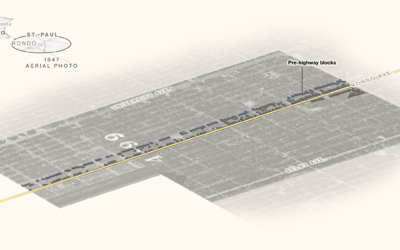
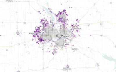
Black neighborhoods split by highways
-
Atlas of the Invisible
James Cheshire and Oliver Uberti teamed up for another book of maps, Atlas…
-
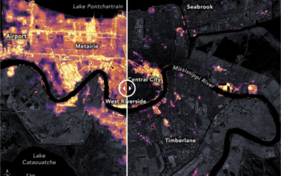
New Orleans power outage seen via satellite imagery
After Hurricane Ida, New Orleans experienced power outages. The NASA Earth Observatory show…
-
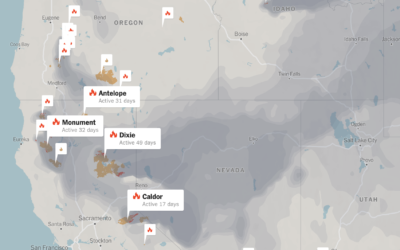
Tracking wildfires in the west
Wildfires continue to burn in the western United States. The New York Times…
-
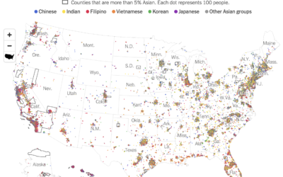
Diversity within the Asian population
Robert Gebeloff, Denise Lu and Miriam Jordan for The New York Times looked…
-
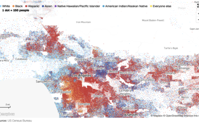
Race and ethnicity map of dots
CNN goes with the dot density map for their first pass on the…
-
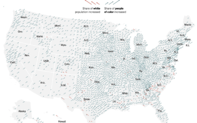
Shift in white population vs. people of color
The New York Times go with the angled arrows to show the shifts…
-
Maps of racial population change
Using their peaks and valleys metaphor, The Washington Post shows the shift in…
-
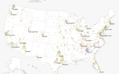
Where America is expanding in developed areas
Zach Levitt and Jess Eng for The Washington Post mapped newly developed areas…
-
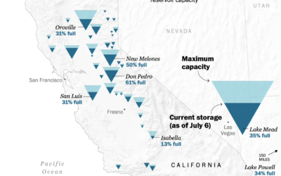
Map of drying reservoirs in the west
To show water levels in California’s drying reservoirs, The Washington Post used upside…
-
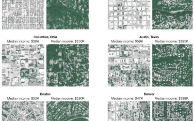
Tree canopy and income
Ian Leahy and Yaryna Serkez for NYT Opinion look at income and tree…
-
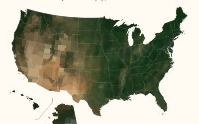
Average color of geographic areas
Based on satellite imagery, Erin Davis found the average color of places around…
-
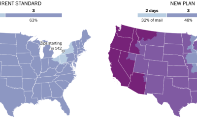
Mail slowdown
Postmaster General Louis DeJoy proposed new standards for first-class mail, which would slow…
-
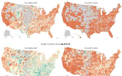
Delaying motherhood
The New York Times mapped birth rates, which are down almost everywhere, especially…
-
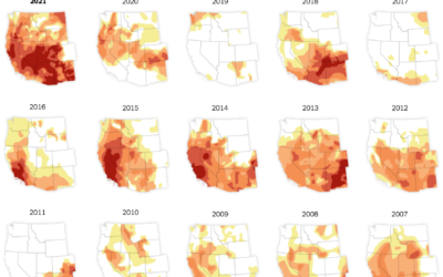
Drought in the Western United States
In what’s become a recurring theme almost every year, the western United States…
-
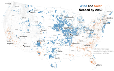
Where wind and solar needs to grow by 2050
Based on estimates from Princeton University’s Net-Zero America Project, Veronica Penney for The…
-
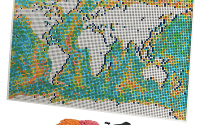
Official LEGO world map set
We’ve seen maps made out of LEGO bricks before, but LEGO is about…
-
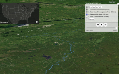
Map shows you where a raindrop ends up
River Runner is a fun interactive map by Sam Learner. Click anywhere in…
Recently for Members
Second Edition
 Visualize This: The FlowingData Guide to Design, Visualization, and Statistics (2nd Edition)
 Visualize This: The FlowingData Guide to Design, Visualization, and Statistics (2nd Edition)
New tools, refined process.
Browse by Chart Type See All →


