In what seems to have become a trend of making more and more…
Maps
Intuitive to look at spatial patterns and great for distributing geographic data.
-
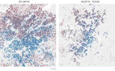
Mapping all of the voters
-
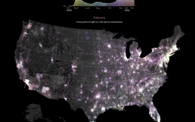
Pandemic timeline as animated dot density map
As a lead-in and backdrop to a timeline of the past year by…
-
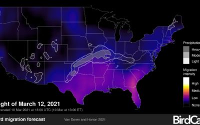
Bird migration forecast maps
BirdCast, from Colorado State University and the Cornell Lab of Ornithology, shows current…
-
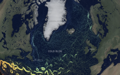
Cooling Gulf Stream
This is quite a dive by Moises Velasquez-Manoff and Jeremy White for The…
-
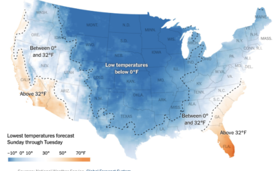
Low temperatures map of the United States
Based on data from the Global Forecast System, The New York Times mapped…
-
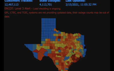
Map of power outages
PowerOutage.US keeps a running tally of outages across the United States, and it’s…
-

Tracking Capitol rioters through their mobile phone data
For NYT Opinion, Charlie Warzel and Stuart A. Thompson returned to the topic…
-
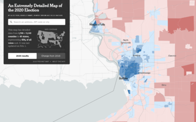
Precinct-level map of 2020 election results
NYT’s The Upshot published their precinct-level map of 2020 election results. Zoom in…
-

Satellite imagery at a cute angle
Maybe you remember the SimCity-like views through satellite imagery from a few of…
-

Scaled-down Biden inauguration
For Bloomberg, Jeremy C.F. Lin and Rachael Dottle show what Joe Biden’s inauguration…
-

Minute-by-minute timeline for what happened at the Capitol
The New York Times outlined the minutes from the speech leading to the…
-
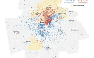
Map of the voting in Georgia, the runoff vs. the general election
For NYT’s The Upshot, Nate Cohn explains how Warnock and Ossoff won Georgia.…
-
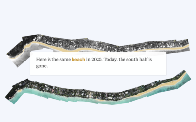
Mapping disappearing beaches in Hawaii
Ash Ngu for ProPublica and Sophie Cocke for Honolulu Star-Advertiser show the harm…
-
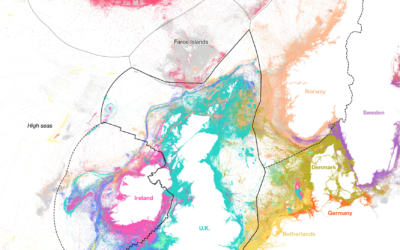
Who catches the most fish
Using data from Global Fishing Watch, Hayley Warren and Ian Wishart for Bloomberg…
-
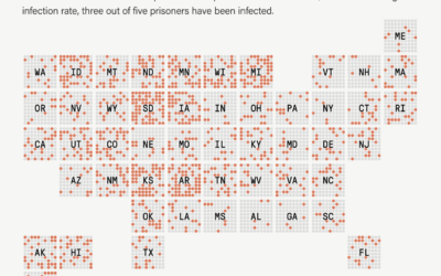
1 in 5 prisoners had Covid-19, a grid map
The Marshall Project and The Associated Press report on the Covid-19 rates in…
-
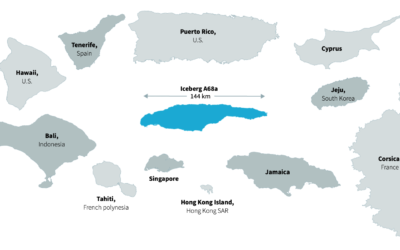
Tracking world’s biggest iceberg
The world’s biggest iceberg, A68a, is on track to crash into a remote…
-
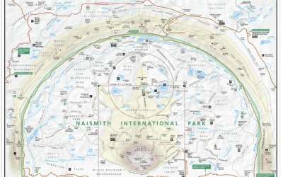
Basketball court designed as a national park map
Kirk Goldsberry, whose basketball charts you might recognize, made the Naismith International Park…
-
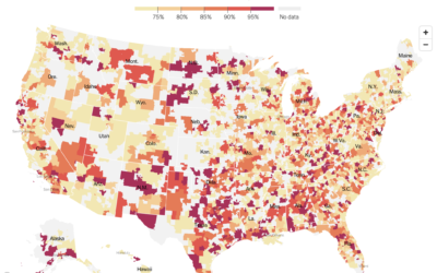
Where ICUs are near capacity
The New York Times mapped the seven-day average of ICU bed occupancy rates:…
Recently for Members
Second Edition
 Visualize This: The FlowingData Guide to Design, Visualization, and Statistics (2nd Edition)
 Visualize This: The FlowingData Guide to Design, Visualization, and Statistics (2nd Edition)
New tools, refined process.
Browse by Chart Type See All →


