Daniel Huffman grew up with an ice cream flavor called Blue Moon. Where…
Maps
Intuitive to look at spatial patterns and great for distributing geographic data.
-
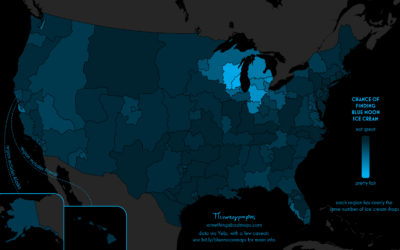
Searching for Blue Moon ice cream
-
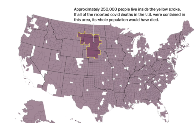
Mapping 250,000 people
As we’ve talked about before, it can be hard to really understand the…
-
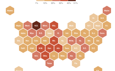
Where there are hospital staff shortages
Reporting for NPR, Sean McMinn and Selena Simmons-Duffins on staffing shortages:
On data…
-
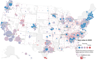
Voting gains for 2020, compared to 2016 election
For The New York Times, Ford Fessenden, Lazaro Gamio and Rich Harris go…
-
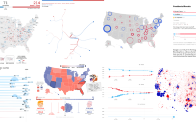
Recap of all the election maps and charts
Alan McConchie from Stamen recaps the wide array of maps and charts that…
-
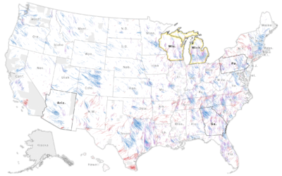
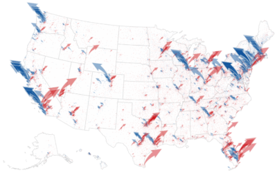
Wind map to show change in vote shares and participation
The Washington Post goes with a wind metaphor to show the change in…
-
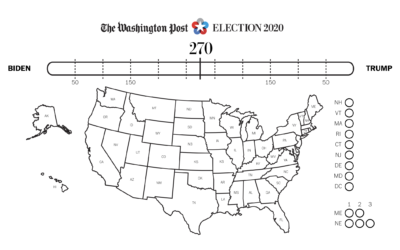
Electoral coloring page
If you want to color in your own electoral map at home, The…
-
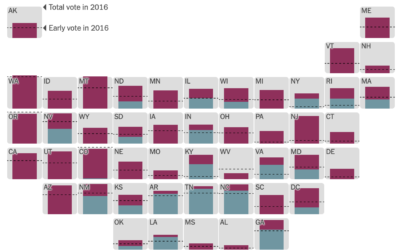
Early voting by state
It’s election day here in the United States, but millions of votes have…
-
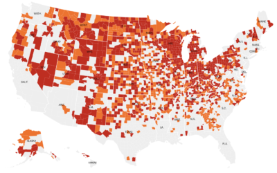
Where coronavirus cases are peaking
With this simple choropleth map, Lauren Leatherby for The New York Times shows…
-

Maps of Home
Dots on a map can feel like, well, just a bunch of dots.…
-
Money raised for the presidential election – by geography, time, and demographic
The New York Times analyzed campaign finance data from April to October, mapping…
-

Vintage relief maps
Muir Way updates vintage relief maps with a third dimension. Pretty. The above…
-
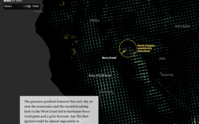
Fires in the west and climate change
This is some advanced mapping and scrollytelling from the Washington Post. The piece…
-
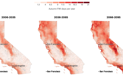
More fire weather days coming
It’s been smoky this season. Based on research from Michael Goss et al.,…
-
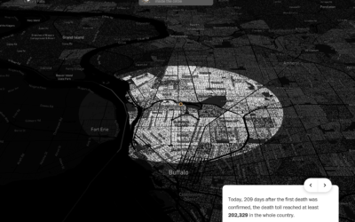
Covid-19 in your neighborhood
With recorded U.S. Covid-19 deaths passing the 200k mark, somehow the number still…
-
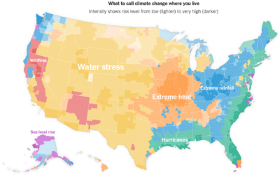
Map of climate threats where you live
For NYT Opinion, Stuart A. Thompson and Yaryna Serkez mapped the most predominant…
-
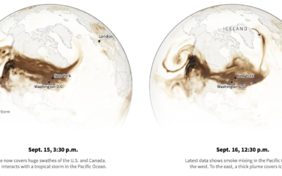
Smoke from the U.S. West Coast travels east and overseas
Smoke from the wildfires made its way to the other side of the…
-
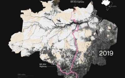
Mapping tree loss in rain forests over time
Bloomberg mapped tree loss between 2000 and 2019 in Brazil:
“What we have…
Recently for Members
Second Edition
 Visualize This: The FlowingData Guide to Design, Visualization, and Statistics (2nd Edition)
 Visualize This: The FlowingData Guide to Design, Visualization, and Statistics (2nd Edition)
New tools, refined process.
Browse by Chart Type See All →


