As we have seen, small shifts in voting behavior of various demographic groups…
Maps
Intuitive to look at spatial patterns and great for distributing geographic data.
-
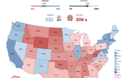
Design your own election scenario
-
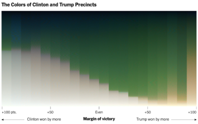
Red-blue electoral map and the green-gray in satellite imagery
For NYT’s The Upshot, Tim Wallace and Krishna Karra looked at how the…
-
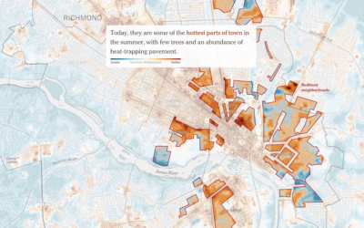
Racist housing policy from 1930s and present-day temperature highs
Brad Plumer and Nadja Popovich for The New York Times show how policies…
-
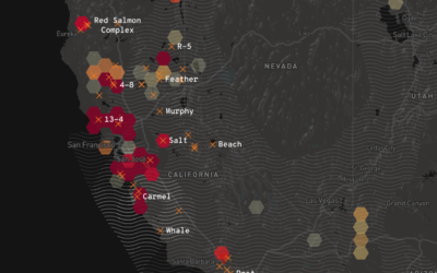
California wildfires map
Los Angeles Times provides a California-specific map of the current wildfires to stay…
-
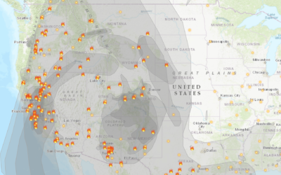
Fire and smoke map
With the rush of wildfires in California, governor Gavin Newsom declared (another) state…
-
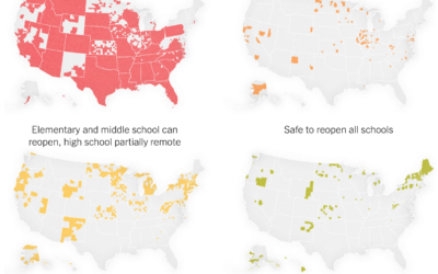
Where schools are ready to reopen
For NYT Opinion, Yaryna Serkez and Stuart A. Thompson estimated where we’re ready:…
-
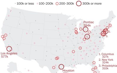
Reduced mail sorting capacity
The United States Postal Service is losing mail sorting machines — as an…
-
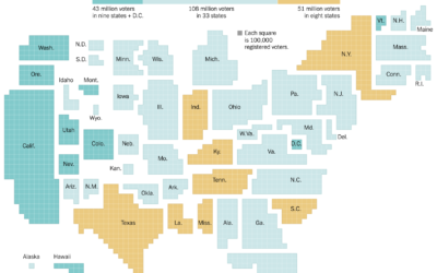
Who can vote by mail
There’s going to be a lot more voting by mail this year. The…
-
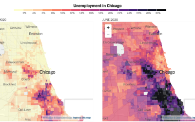
Distribution of unemployment at the tract level
We’ve been hearing a lot about national unemployment rate, but it’s not uniformly…
-
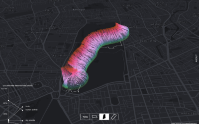
Park sounds before and during the pandemic
With lockdown orders arounds the world, places that we’re allowed to go sound…
-
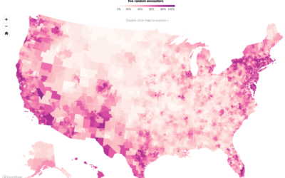
Where people are wearing masks
NYT’s The Upshot ran a survey through the data firm Dynata asking people…
-
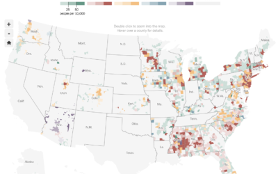
Race and the virus
The New York Times obtained data on race and those affected by the…
-
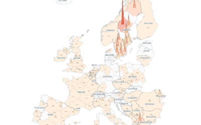
Coronavirus counts across Europe
Going with the shaded triangle peaks to show case counts and deaths, The…
-
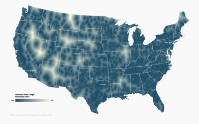
Map shows where to go to get away from fireworks
Using a voronoi map, David Yanofsky for Quartz mapped the places in the…
-
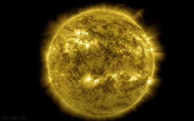
Decade-long time-lapse of the sun
NASA’s Solar Dynamics Observatory has been taking a picture of the sun every…
-
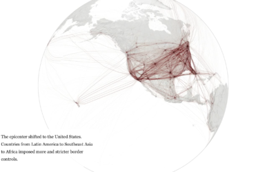
When the world shut down, seen through global flights
Lauren Tierney and William Neff for The Washington Post used a rotating globe…
-
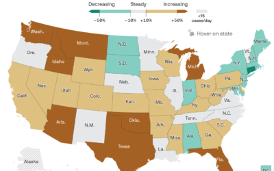
Map of Covid-19 surge
Axios provides a straightforward state map showing the percentage change in the 7-day…
-
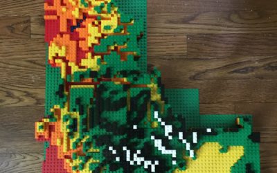
LEGO relief map
Cameron Bennett made a relief map of Idaho, completely out of LEGO bricks:…
Recently for Members
Second Edition
 Visualize This: The FlowingData Guide to Design, Visualization, and Statistics (2nd Edition)
 Visualize This: The FlowingData Guide to Design, Visualization, and Statistics (2nd Edition)
New tools, refined process.
Browse by Chart Type See All →


