Stamen, whose design breakdowns I always appreciate, discusses why they took a different…
Stamen
-
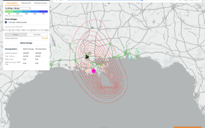
Mapping hurricane winds with avocado of uncertainty
-
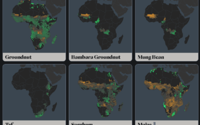
Mapping the crops with the most potential in a changing climate
The climate is changing, which means some crops will fair better or worse…
-
Watercolor Maptiles by Stamen are now part of the Smithsonian’s permanent collection
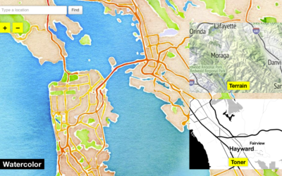
In 2012, Stamen Design released watercolor map tiles based on OpenStreetMap data. It…
-
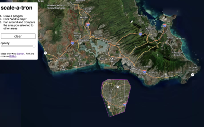
Compare the scale of any area in the world
Riffing on the Ever Given Ever Ywhere, which lets you place the Ever…
-
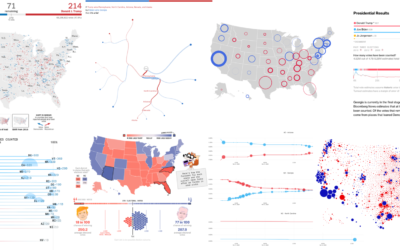
Recap of all the election maps and charts
Alan McConchie from Stamen recaps the wide array of maps and charts that…
-
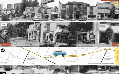
Exploration of 12 timelines along Sunset Boulevard
In 1966, artist Ed Ruscha published Every Building on the Sunset Strip, which…
-
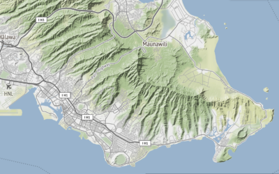
Global terrain maps from Stamen
Missed this one from last month. Stamen announced the release of a whole…
-
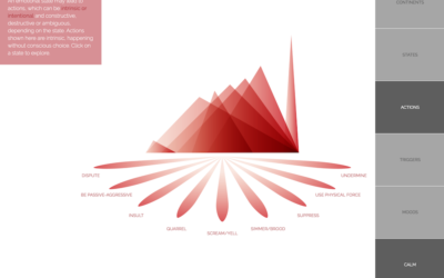
Atlas of Emotions, a collaboration with the Dalai Lama
Emotions are complex and only partially understood, yet such a force in how…
-
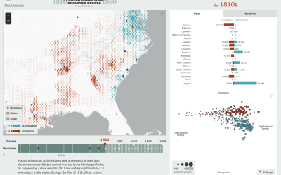
Atlas of United States history
In a collaboration between the Digital Scholarship Lab at the University of Richmond…
-

Eric Rodenbeck on visualization and running a studio
Eric Rodenbeck is the founder and creative director for Stamen. No doubt you’ve…
-
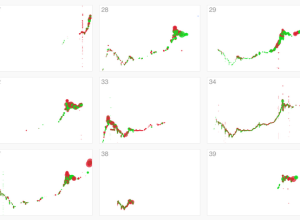
Failed Bitcoin market activity
Stamen visualized Bitcoin activity, noting a variety of traders who knew what they…
-
Easy mapping with Map Stack
It seems like the technical side of map-making, the part that requires code…
-
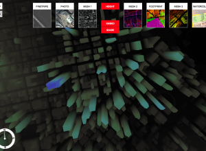
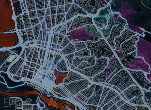
An experimental map service using 3-D data
For the past few months, Stamen Design has been working with 3-D data…
-

How viral photos spread on Facebook
Number of likes and shares for a Facebook post are just simple aggregates…
-
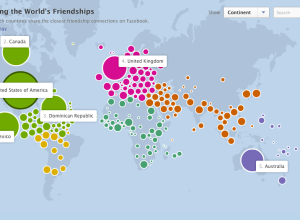
How people are connected on Facebook, by country
As part of the Stories initiative that Facebook launched yesterday, an interactive map…
-
Infographics are like Mother’s Day cards
Stamen Design is the cover story of this month’s Icon Magazine. Well deserved.…
-
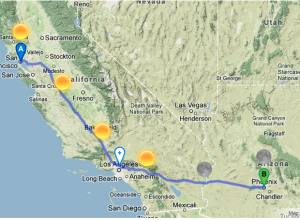
Road trip planner with weather forecasts
Online maps have made it easy to find directions from point A to…
-
Rising Water Levels in the Immediate Future
Stamen Design, in collaboration with Climate Central, shows major areas that could be…
-
Watercolor Map Tiles
A couple of years ago, when you thought about online interactive maps, what…
-
Abstract maps of the United States
Esquire invited a handful of map-makers to represent the United States outside its…
Recently for Members
Second Edition
 Visualize This: The FlowingData Guide to Design, Visualization, and Statistics (2nd Edition)
 Visualize This: The FlowingData Guide to Design, Visualization, and Statistics (2nd Edition)
New tools, refined process.
Browse by Chart Type See All →


