Alastair Humphreys, using a 20 by 20 kilometer map of where he lives,…
Maps
Intuitive to look at spatial patterns and great for distributing geographic data.
-

Local wanderlust
-
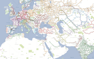
World railway map
Usually you see a railway map from a local perspective, because it’s meant…
-
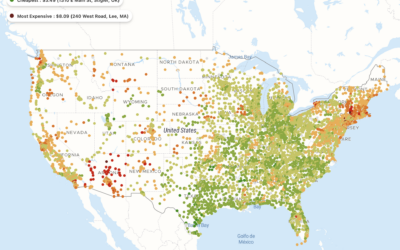
Cost of a Big Mac at every McDonald’s in the United States
A map, by Pantry & Larder, shows the cost of a Big Mac…
-
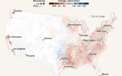
Shifting bird populations
Using data from the crowdsourced database eBird, Harry Stevens mapped the shifts in…
-
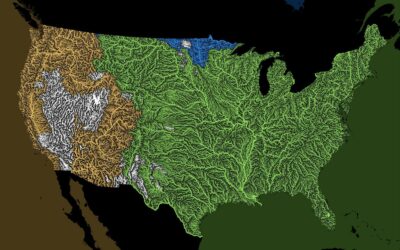
Oceans that all the rivers drain
Rivers drain into oceans. Grasshopper Geography color-coded the rivers in the world by…
-
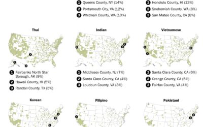
Where restaurants serve Asian cuisines in the U.S.
You can find Asian restaurants in most places in the United States, but…
-
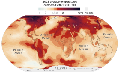
Where it warmed the most in the world
Earth got its hottest year on record in 2023. Based on data from…
-
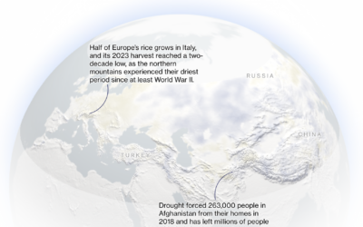
Snow drought
A warming climate has meant less snow in the northern hemisphere, which is…
-
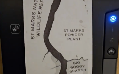
Map with a receipt printer
Aaron Koelker used a receipt printer to print a six-foot long map of…
-
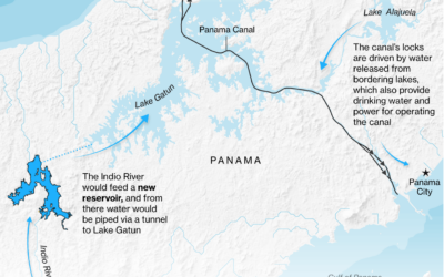
Repairing Panama Canal water levels
For Bloomberg, Peter Millard and Michael D. McDonald report on the efforts to…
-
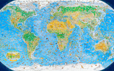
World map of illustrated animals
During a three-year span, Anton Thomas illustrated a world map of 1,642 animals…
-
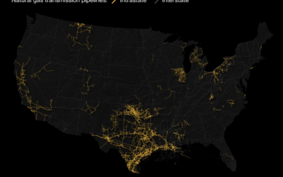
High concentration of intrastate pipelines in Texas
By keeping gas pipelines within the state, companies can avoid federal regulations. This…
-
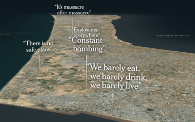
Life in the Gaza Strip
The New York Times put together an image of what life is like…
-
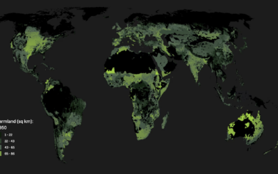
Running out of space to grow food
For Associated Press, Christina Larson and Nicky Forster examined the growing population and…
-
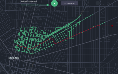
Animated map shows the search for the best path
When you look up directions with a mapping application, there are algorithms that…
-
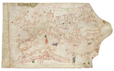
Historical chart valued at $7.5m
The map sold for $239,000 at a Christie’s auction, but it was misdated…
-
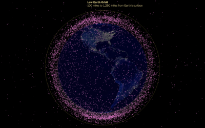
Thousands of satellites orbiting Earth
The Washington Post looked at the many satellites orbiting our planet. A globe…
-
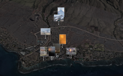
Maui fires timeline, a visual reconstruction of the events
Using a combination of weather reports, videos, and 911 calls, The New York…
Recently for Members
Second Edition
 Visualize This: The FlowingData Guide to Design, Visualization, and Statistics (2nd Edition)
 Visualize This: The FlowingData Guide to Design, Visualization, and Statistics (2nd Edition)
New tools, refined process.
Browse by Chart Type See All →


