Bringing in data from various federal agencies:
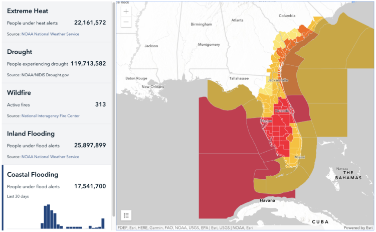
Climate Mapping for Resilience and Adaptation (CMRA) integrates information from across the federal government to help people consider their local exposure to climate-related hazards. People working in community organizations or for local, Tribal, state, or Federal governments can use the site to help them develop equitable climate resilience plans to protect people, property, and infrastructure.
 Visualize This: The FlowingData Guide to Design, Visualization, and Statistics (2nd Edition)