For The New York Times, Derek Watkins used animated maps to show how…
Maps
Intuitive to look at spatial patterns and great for distributing geographic data.
-
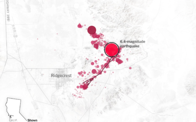
Earthquake trigger
-
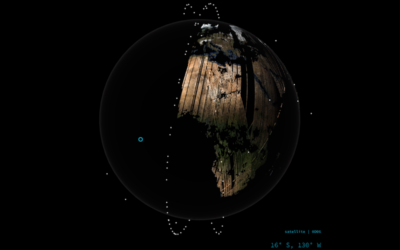
Imaging Earth on the daily
Over the past four years, Planet deployed 293 satellites in low orbit to…
-
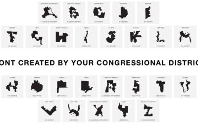
Gerry, a font based on gerrymandered congressional districts
Gerry uses congressional district boundaries as letters. Hahahahaha. Oh wait.…
-
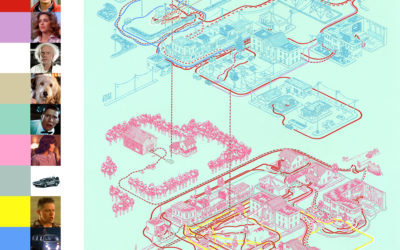
Maps of the movies and their characters
Andrew DeGraff painted maps that show the geography in movies and their characters’…
-
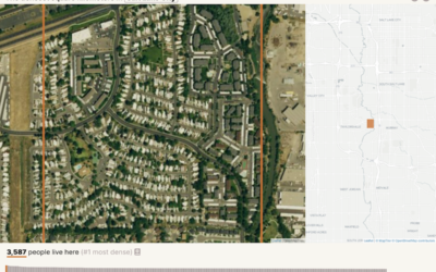
Searching for the densest square kilometer in different cities
Based on data from Gridded Population of the World, geographer Garrett Dash Nelson…
-
Airport runway orientation reveals wind patterns
Airport runways orient certain directions that correlate with wind direction in the area.…
-
Animated maps of seasonal Earth
As you might expect, NASA collects a lot of data, and much of…
-
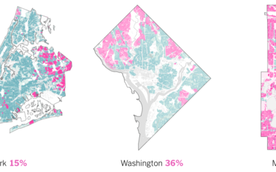
Home zoning in major cities
The single-family home. It’s part of the American dream, but it can be…
-
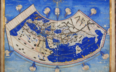
The role of cartography in early global explorations
For Lapham’s Quarterly, Elizabeth Della Zazzera turns back the clock to maps used…
-
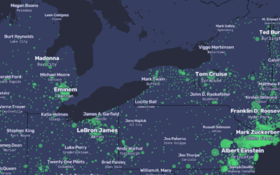
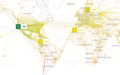
Map of the most popular people replacing the cities they lived in
For The Pudding, Matt Daniels and Russell Goldenberg used Wikipedia pageviews to replace…
-
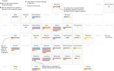
New abortion restrictions by state, since 2011
For FiveThirtyEight, Amelia Thomson-DeVeaux and Gus Wezerek categorized and mapped new abortion restrictions…
-
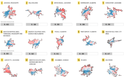
Mapping politically polarized cities
Rachael Dottle, for FiveThirtyEight, looked for political differences in cities and ranked them,…
-
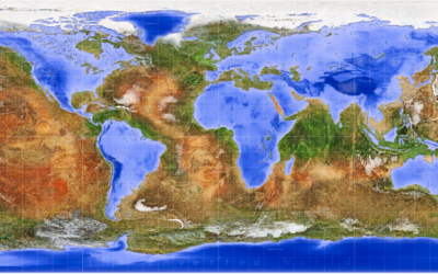
Inverted world map
Frans Block wondered what the world would look like if water and land…
-
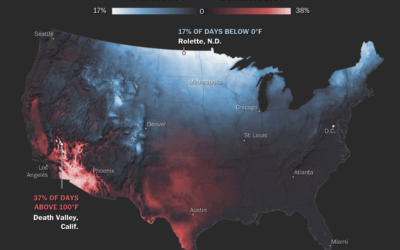
Maps of natural disasters and extreme weather
For The Washington Post, Tim Meko mapped floods, tornados, hurricanes, extreme temperatures, wildfires,…
-
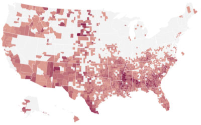
Where the IRS most likely audits
Using estimates from a study on regional bias in tax audits, ProPublica mapped…
-
Mapping the cheapest flights to everywhere, given your location
Sometimes you really do need to get away. Escape, part search engine and…
-
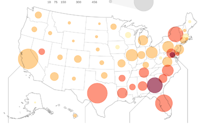
Robocalls map
Other than calls from my wife, I can’t even remember the last call…
-
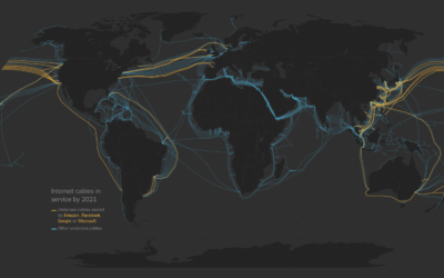
Internet under the sea
To connect servers around the world, there are actual cables that run under…
Recently for Members
Second Edition
 Visualize This: The FlowingData Guide to Design, Visualization, and Statistics (2nd Edition)
 Visualize This: The FlowingData Guide to Design, Visualization, and Statistics (2nd Edition)
New tools, refined process.
Browse by Chart Type See All →


