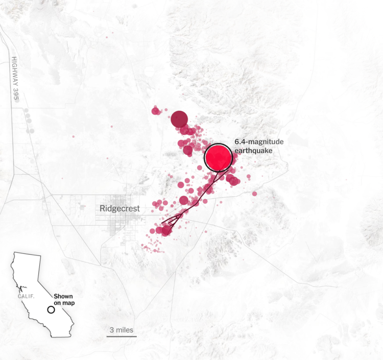
For The New York Times, Derek Watkins used animated maps to show how a large earthquake can lead to thousands of small ones.
Living in California, I’ve experienced a handful of these, but it had been a while before feeling one a few weeks ago. I may or may not have immediately started looking at earthquake insurance.
 Visualize This: The FlowingData Guide to Design, Visualization, and Statistics (2nd Edition)