The New York Times used a mix of media and data sources to…
flood
-

Visual reconstruction of flooding at Camp Mystic
-
Maps for why all the flash floods
It is “flash flood month” in the United States, brought on by high…
-
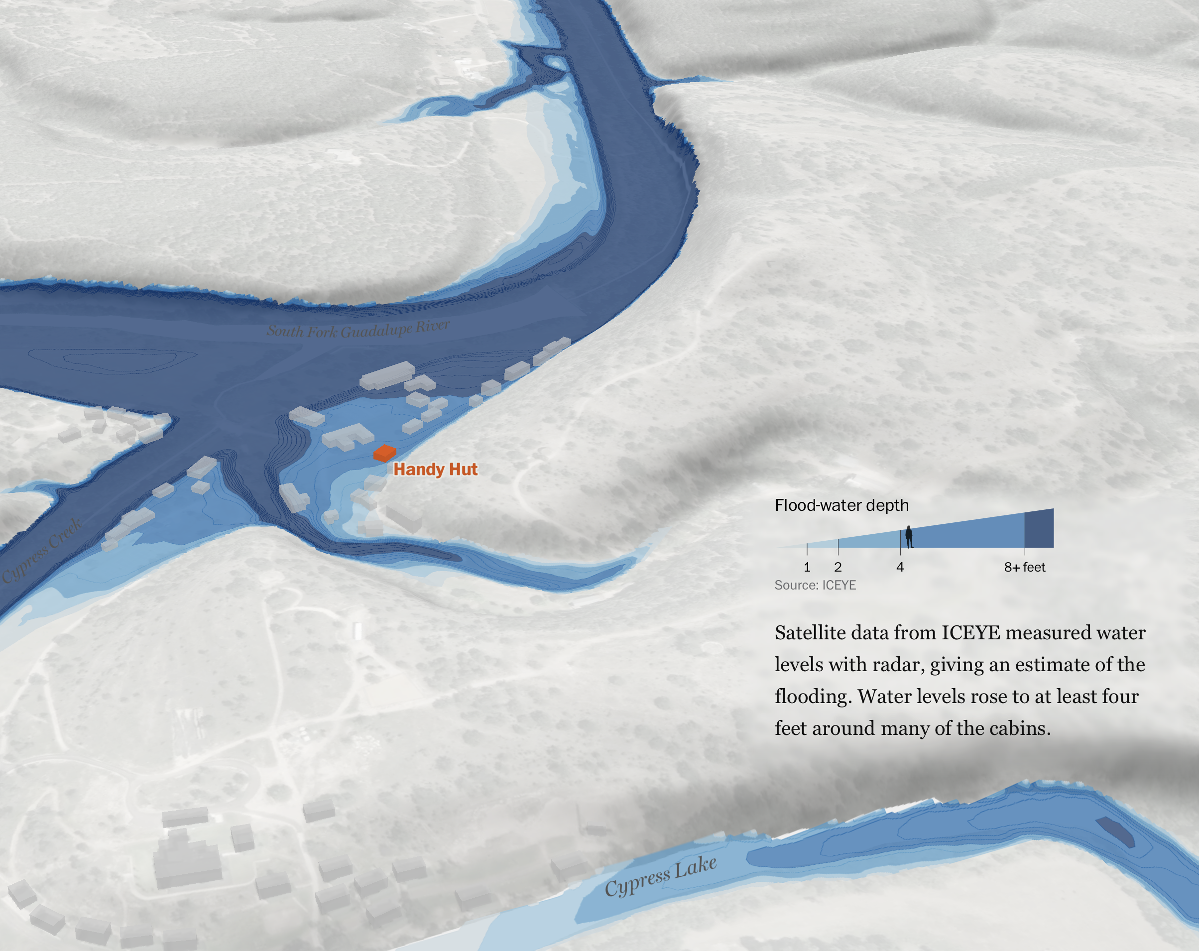
What happened at Camp Mystic
The Washington Post reconstructed the flooding at Camp Mystic, from the perspectives of…
-
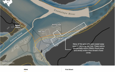
FEMA flood risk vs. more comprehensive estimates for Camp Mystic
Risk estimates change by statistical model and what that model accounts for. The…
-
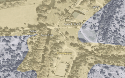
Map of flood-risk area at Camp Mystic
The New York Times mapped an overhead view of Camp Mystic with flood-risk…
-
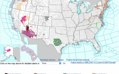
Map of alerts from the National Weather Service
We are seeing in real-time why the National Weather Service, a part of…
-
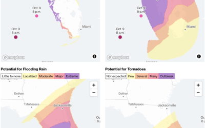
Hurricane Milton potential threats
Hurricane Milton continues towards Florida, estimated to make landfall on October 9, 2024…
-
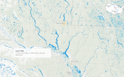
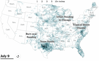
Sprawling flood waters across the Midwest and South
The New York Times mapped the slow, wide-reaching flood waters this year so…
-
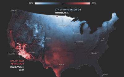
Maps of natural disasters and extreme weather
For The Washington Post, Tim Meko mapped floods, tornados, hurricanes, extreme temperatures, wildfires,…
-
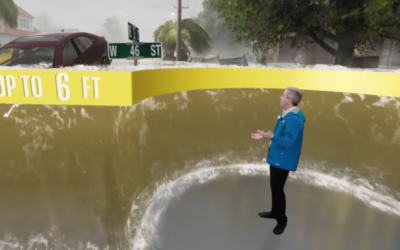
Realistic storm surge depicted in Weather Channel forecast
The Weather Channel is using a realistic 3-D depiction surrounding a reporter to…
-
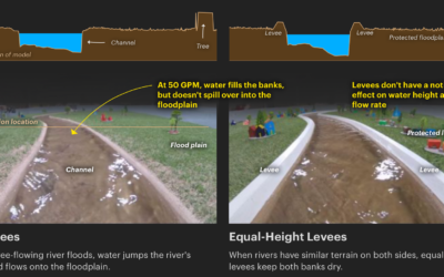
Scale model shows how levees increase flooding
Levees are intended to prevent flooding in the areas they are built, but…
-
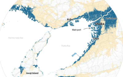
Cities projected to be under water by 2100
Using Climate Central sea-level rise estimates, The Guardian plots and maps the potential…
-
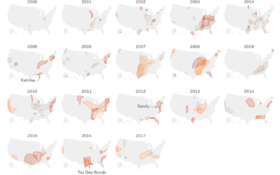
Thirty years of floods
Based on data from the Dartmouth Flood Observatory, Lazaro Gamio for Axios mapped…
-
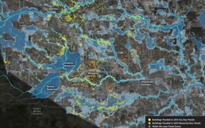
Houston flooding on the rise
Climate change is doing some weird stuff. What were once rare weather events…
Recently for Members
Second Edition
 Visualize This: The FlowingData Guide to Design, Visualization, and Statistics (2nd Edition)
 Visualize This: The FlowingData Guide to Design, Visualization, and Statistics (2nd Edition)
New tools, refined process.
Browse by Chart Type See All →


