Randall Munroe, Kelsey Harris, and Max Goodman for xkcd mapped all the challengers…
Maps
Intuitive to look at spatial patterns and great for distributing geographic data.
-
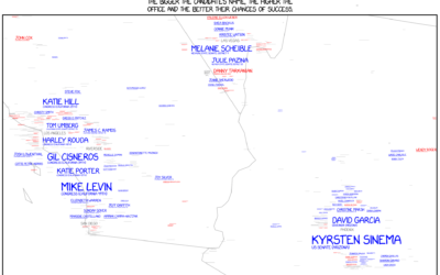
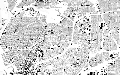
xkcd maps 2018 midterm election challengers
-
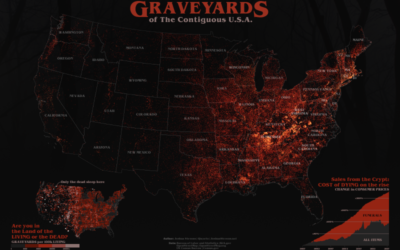
Graveyards of America mapped
It’s Halloween. Joshua Stevens mapped all the graveyards:
Right away I was struck… -
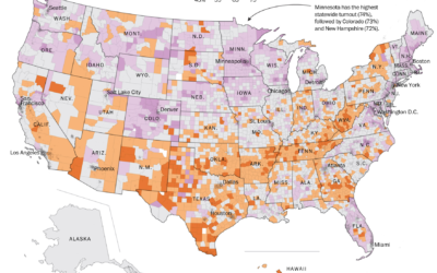
Geography of voter turnout
Based on data from Dave Leip’s Atlas of U.S. Presidential Elections, The Washington…
-
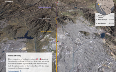
A closer look at the U.S.-Mexico border
The Washington Post provides a flyover view of the barriers at the U.S.-Mexico…
-
Mapping all the buildings
A few months back, Microsoft released a comprehensive dataset that included the estimated…
-
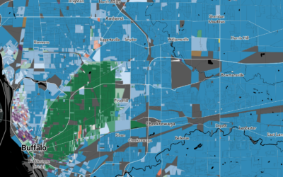
Mapping predominant race block by block
Based on data from the Census Bureau, National Geographic mapped predominant race in…
-
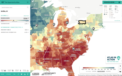
Mapping opportunity for children, based on where they grew up
Opportunity Atlas, a collaboration between Opportunity Insights and the Census Bureau, is the…
-
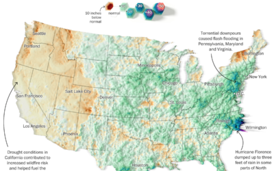
Summer rain levels compared to the norms
Tim Meko and Aaron Steckelberg for The Washington Post compared this summer’s rains…
-
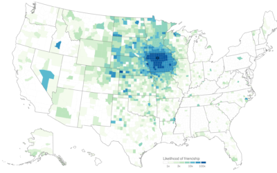
Judging connectedness of American communities, based on Facebook friendships
We talk about geographic bubbles a lot these days. Some areas are isolated,…
-
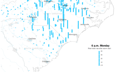
Watch rising river levels after Hurricane Florence
Hurricane Florence brought a lot of rain, which in turn made river levels…
-
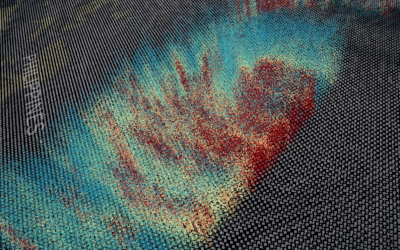
3-D view inside Typhoon Mangkhut
Typhoon Mangkhut went through the northern end of the Phillipines a few days…
-
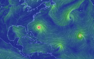
Hurricane Florence trackers
Hurricane Florence is forecast to touch down Thursday night or Friday, and what’s…
-
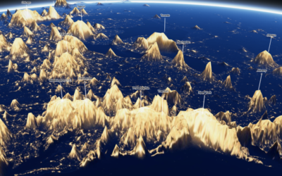
Night lights mapped as terrain
You’ve probably seen the maps of Earth at night. It gives you a…
-
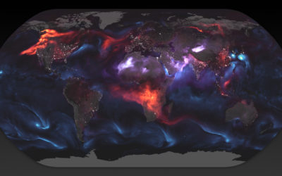
World map shows aerosol billowing in the wind
Using a mathematical model based on satellite data, NASA shows an estimate of…
-

World Cup play activity visualized like wind maps
A fun experiment by Neil Charles that used the aesthetics of wind maps…
-
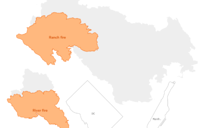
Scale of the California wildfires
The Mendocino Complex Fire, now the largest in California ever, continues to burn.…
-
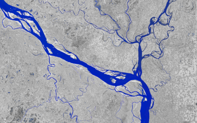
A transforming river seen from above
The Padma River in Bangladesh is constantly shifting its 75-mile path. Joshua Stevens…
-
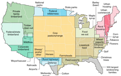
How America uses its land
Dave Merrill and Lauren Leatherby for Bloomberg visualized land use for the conterminous…
Recently for Members
Second Edition
 Visualize This: The FlowingData Guide to Design, Visualization, and Statistics (2nd Edition)
 Visualize This: The FlowingData Guide to Design, Visualization, and Statistics (2nd Edition)
New tools, refined process.
Browse by Chart Type See All →


