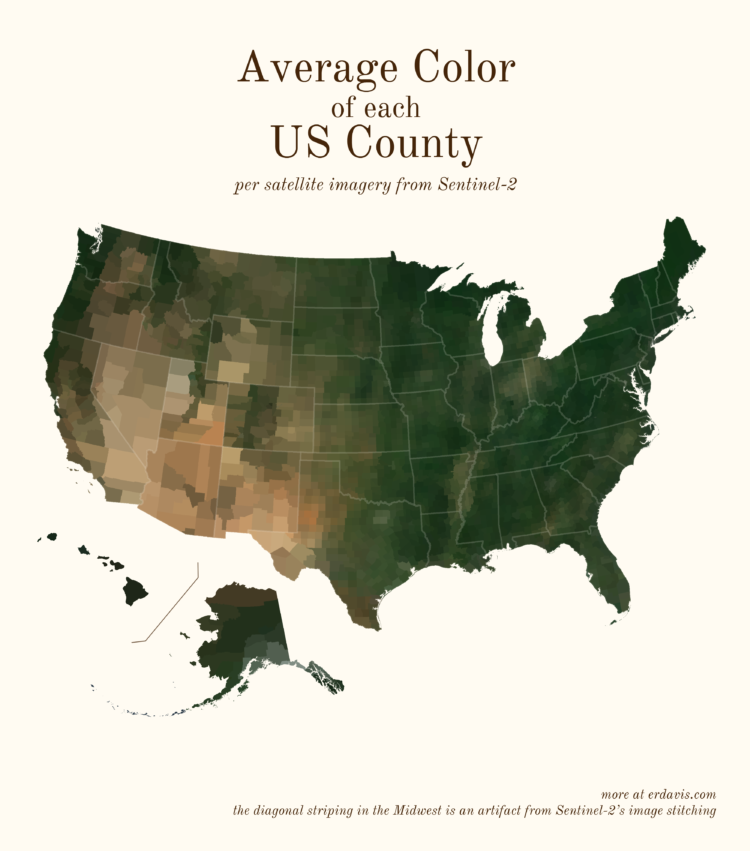
Based on satellite imagery, Erin Davis found the average color of places around the world. The above is by county in the United States, but Davis also made maps by country, which are a mix of greens, browns, and yellows.
See also the NYT piece from 2020, which framed color by political leaning.
 Visualize This: The FlowingData Guide to Design, Visualization, and Statistics (2nd Edition)