NASA makes a lot of live data available about the Artemis II mission.…
NASA
-
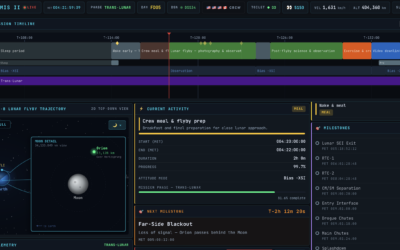
Artemis II tracker, to know if the space toilet is working
-
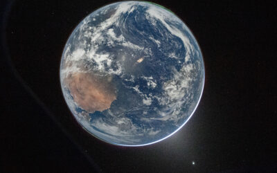
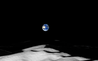
First images from Artemis II astronauts
The first downlinked images were published by NASA. The best view of Earth’s…
-
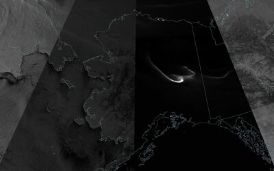
Shades of a lunar eclipse
There was a total lunar eclipse on March 3, 2026. From Michala Garrison…
-

See wind data on Mars through tele-present wind
With the art installation tele-present wind, David Bowen displays data collected by NASA’s Perseverance rover mission.
-
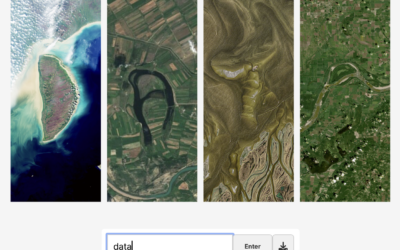
Spell your name with satellite imagery
Here’s a fun interactive from NASA Landsat that lets you enter your name…
-
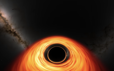
Visualization of flying into a black hole
Assuming you were still alive flying into a black hole, NASA’s Goddard Space…
-
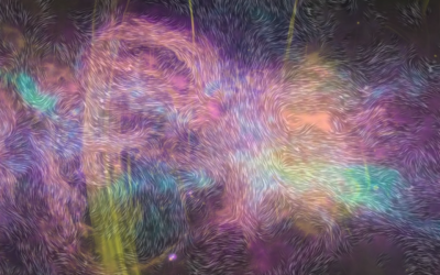
Map of magnetic fields in the Milky Way
Based on data from NASA’s Stratospheric Observatory For Infrared Astronomy (SOFIA), Villanova University…
-

Objects in space headed towards Earth
NASA’s Center for Near Earth Object Studies tracks large objects, such as asteroids,…
-
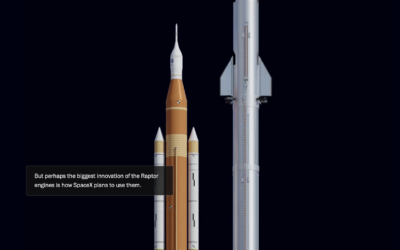
Differing approaches between SpaceX and NASA to sending rockets to the moon
For The Washington Post, William Neff, Aaron Steckelberg, and Christian Davenport show the…
-
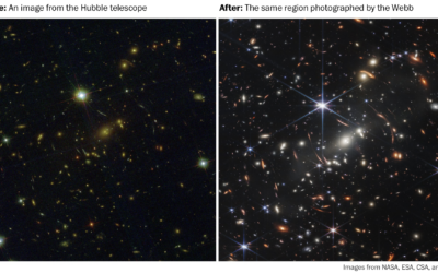
Why the galaxy pictures from the Webb telescope are pretty cool
The first public picture from the James Webb telescope is kind of cool…
-

A lot of galaxies
NASA released an image from the Webb First Deep Field telescope, which shows…
-
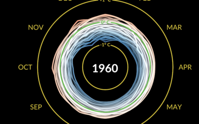
Climate spiral to show temperature change
Say what you will about circular visualization, but the spiral plays. This one…
-
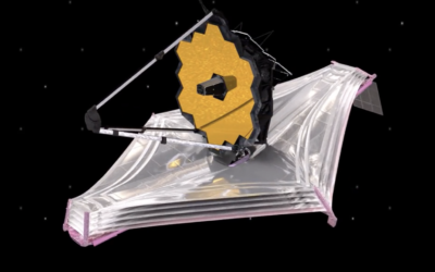
Launching a telescope to explore the Big Bang
NASA is launching the James Webb Space Telescope on December 22, 2021 with…
-
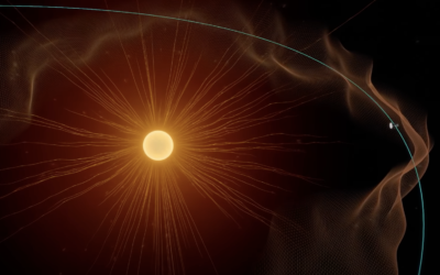
NASA solar probe touched the sun
NASA launched the Parker Solar Probe in 2018 in an effort to explore closer to the sun.
-
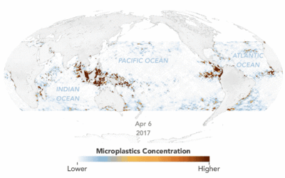
Animated map of microplastics in the ocean
Using estimates based on satellite data, Joshua Stevens for NASA Earth Observatory mapped…
-
A view from the Moon’s south pole
NASA Goddard visualized the point of view from the south pole of the…
-

New Orleans power outage seen via satellite imagery
After Hurricane Ida, New Orleans experienced power outages. The NASA Earth Observatory show…
-
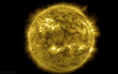
Decade-long time-lapse of the sun
NASA’s Solar Dynamics Observatory has been taking a picture of the sun every…
-
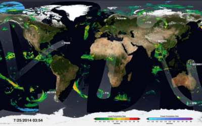
Map shows how NASA satellites collect global rain data
We can download data as a single snapshot in a single file, but…
-
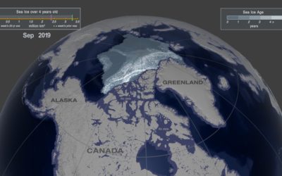
Arctic ice melting
One way to gauge the amount of ice in the Arctic is to…
Recently for Members
Second Edition
 Visualize This: The FlowingData Guide to Design, Visualization, and Statistics (2nd Edition)
 Visualize This: The FlowingData Guide to Design, Visualization, and Statistics (2nd Edition)
New tools, refined process.
Browse by Chart Type See All →


