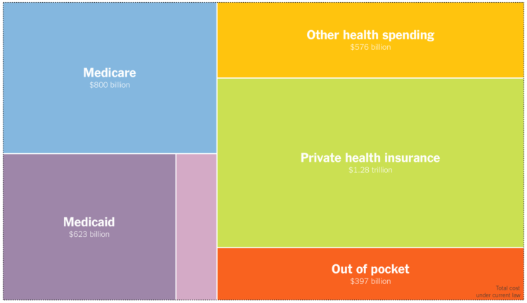
For The Upshot, Josh Katz, Kevin Quealy, and Margot Sanger-Katz, consulted economists to ask what the cost of Medicare for all might look like:
The proposals themselves are vague on crucial points. More broadly, any Medicare for all system would be influenced by the decisions and actions of parties concerned — patients, health care providers and political actors — in complex, hard-to-predict ways. But seeing the range of responses, and the things that all the experts agree on, can give us some ideas about what Medicare for all could mean for the country’s budget and economy.
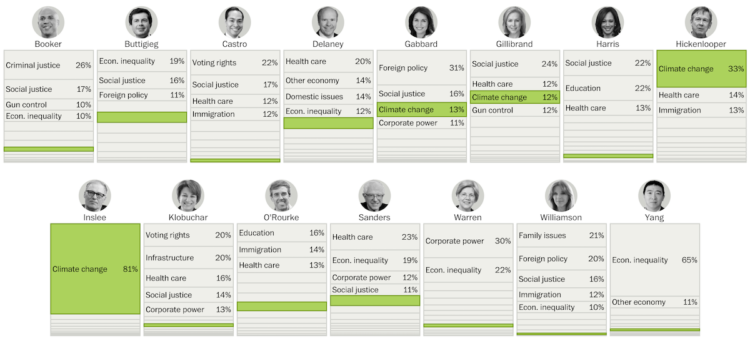
The treemap shows the categories of spending, and the overall size of the treemap changes based on the total cost. Blast from the past.


 Visualize This: The FlowingData Guide to Design, Visualization, and Statistics (2nd Edition)


