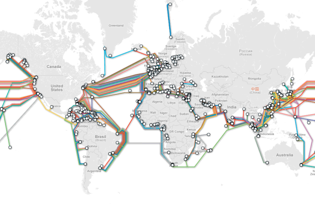
TeleGeography maps underwater cables that connect countries and continents:
TeleGeography’s free interactive submarine cable map is based on our authoritative Global Bandwidth research, and depicts 188 active and planned submarine cable systems and their landing stations. Selecting a cable route on the map provides access to data about the cable, including the cable’s name, ready-for-service (RFS) date, length, owners, website, and landing points. Selecting a landing point provides a list of all submarine cables landing at that station.
Just imagining cables that stretch that far seems pretty amazing.
[Thanks, Harvey]


 Visualize This: The FlowingData Guide to Design, Visualization, and Statistics (2nd Edition)


