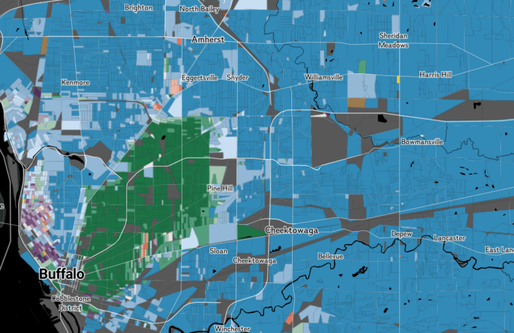
Based on data from the Census Bureau, National Geographic mapped predominant race in 11 million administrative regions in the United States. Many of the regions are the size of a single block.
Looking at the national overview, the country looks predominantly white (represented blue), but as you zoom in for more details, you start to see the mix.
 Visualize This: The FlowingData Guide to Design, Visualization, and Statistics (2nd Edition)