As part of the Stories initiative that Facebook launched yesterday, an interactive map…
Maps
Intuitive to look at spatial patterns and great for distributing geographic data.
-
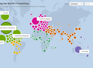
How people are connected on Facebook, by country
-
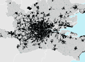
Mapping urban footprint
After identifying 129 metropolitan regions that represent 35 percent of the world’s urban…
-
How NASA visualizes large datasets
Horace Mitchell, director of the NASA Scientific Visualization Studio discusses the process behind…
-
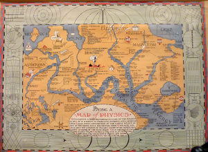
Physics as a geographic map
The fictional map of physics by Bernard H. Porter in 1939 reads:
Containing… -
Link
Making of Perpetual Ocean →
Making of Perpetual Ocean. NASA interview on how they made this; surprisingly, they used Maya and RenderMan
-
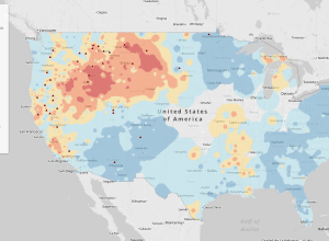
Fire forecasts across the United States →
As megafires in the Southwest are becoming the new normal, NPR reports in…
-
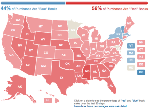
Amazon election map, based on book sales
Amazon used their book sales data to color a map red and blue.…
-
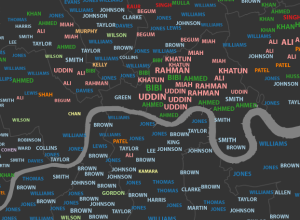
Most common London surnames mapped
James Cheshire, a geography lecturer at the University College London, mapped common surnames…
-
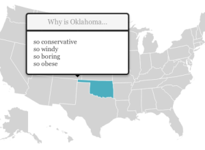
State stereotypes suggested by Google
Renee DiResta got to wondering about state stereotypes, so she looked them up…
-
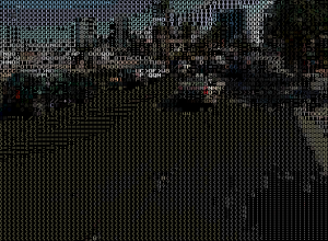
Ascii Street View →
Peter Nitsch created Ascii Street View, converting Google Street View to colored letters.…
-
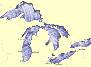
Great Lakes currents map
Using the same tech Martin Wattenberg and Fernanda Viegas created to show wind…
-
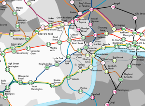
Life expectancy and child poverty as a tube map
Geographers James Cheshire and Oliver O’Brien visualized life expectancy in London as a…
-
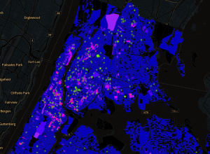
Stop-and-frisk hotspots mapped →
WNYC mapped all street stops that resulted in the recovery of a gun,…
-
The future of maps isn’t maps →
Rebecca Rosen for The Atlantic on why maps aren’t the best interface all…
-
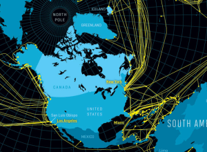
Map of the underwater Internet →
Nicolas Rapp, for Fortune Magazine, mapped the underwater cables that make the global…
-
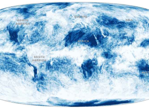
A year of global cloud coverage →
Jonathan Corum for the New York Times mapped cloud coverage from April 2011…
-
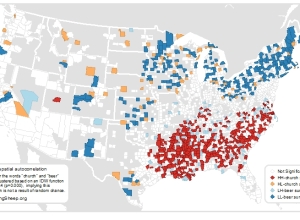
Beer versus church mapped →
The geographers at Floatingsheep are at it again, this time comparing tweets that…
-
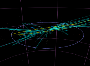
Stars in the zodiac constellations, from Earth and space
While we’re on the subject of stars, developer Riley Davis modeled the ones…
Recently for Members
Second Edition
 Visualize This: The FlowingData Guide to Design, Visualization, and Statistics (2nd Edition)
 Visualize This: The FlowingData Guide to Design, Visualization, and Statistics (2nd Edition)
New tools, refined process.
Browse by Chart Type See All →


