Science Friday had mathematician Paulina Rowińska as guest to talk maps.
It’s easy…
projections
-
Math to map the world
-
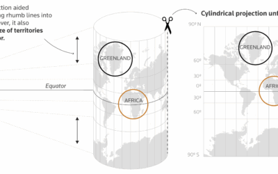
Explaining the true size of Africa, a lesson in map projections
For Reuters, Mariano Zafra and Sudev Kiyada highlight the true size of Africa…
-
There is no correct map
Speaking of the Correct the Map campaign, Miguel García Álvarez reminds that there…
-
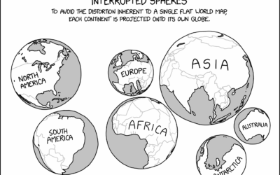
xkcd globe projections
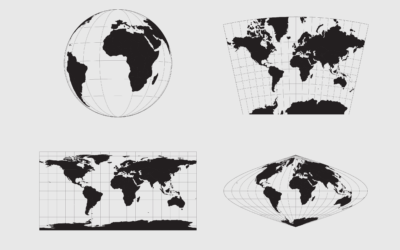
The problem with two-dimensional map projections is distortion creeps in no matter what…
-
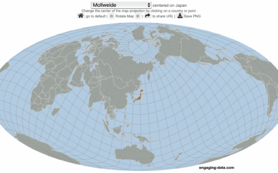
Center the map on the country you want
Speaking of maps centered on specific countries, Engaging Data made an interactive map…
-

World map with south on top and Brazil in center
The Brazilian Institute of Geography and Statistics (IBGE), Brazil’s agency for statistics and…
-
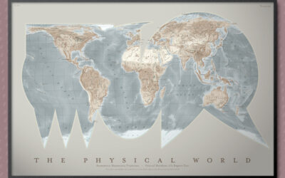
Asymmetric Monstrosity map projection
Part amusement and part learning exercise, the “asymmetric monstrosity” by Daniel Huffman is…
-
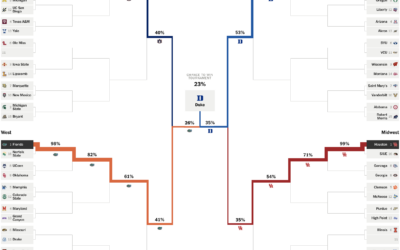
Projections for NCAA basketball tournament, winning chances for each team
Leading up to the NCAA Men’s basketball tournament, the Athletic has a bracket…
-
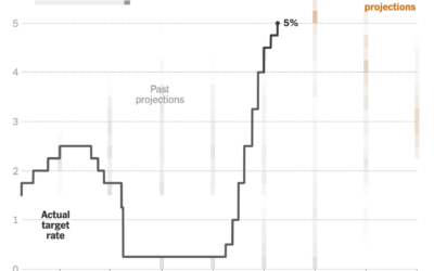
Changing Fed projections
This clever chart by Lazaro Gamio shows changing interest rates set by the…
-
Shrinking the Mercator projection to equal area
It’s been a while since we got our regular reminder that the Mercator…
-
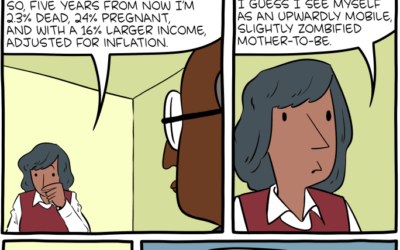
Five years from now
Saturday Morning Breakfast Cereal can see the future.…
-
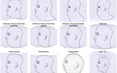
Interactive shows map projections with a face
We’ve seen faces as map projections before, but this is 63 projections on…
-

Immersive digital waves to visualize nature
FLOW is an interactive art installation by Maotik that represents real-time weather data…
-
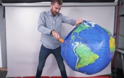
Physical demo of how all maps are wrong
We’ve seen many one-off projects that show the distortions you get when you…
-
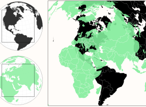
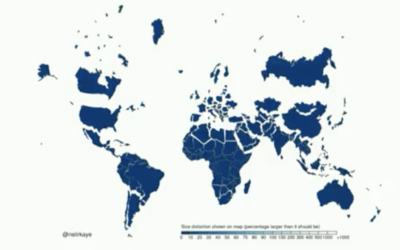
A more realistic perspective of country sizes
Most of us have seen the True Size of Africa graphic that squishes…
-
Members Only
Working with Map Projections and Shapefiles in R
No need to settle for the mapping defaults in R. Apply map projections to show geographic data in a way most suitable for your work.
-
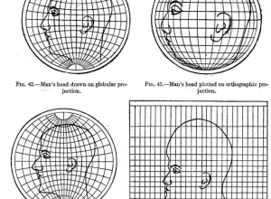
Map projections illustrated with a face
Most people, at least those who visit sites like FlowingData, know about map…
-
Impressive exploration of projection mapping
Projection mapping is the art of using physical objects as display surfaces and…
-
Link
A Globe Hack and Good Old Mercator
A Globe Hack and Good Old Mercator. An illustration of the Mercator map projection using pennies. There’s some distortion.
-
Link
D3 map projections →
A collection by Jason Davies of the map projections possible with D3
Recently for Members
Second Edition
 Visualize This: The FlowingData Guide to Design, Visualization, and Statistics (2nd Edition)
 Visualize This: The FlowingData Guide to Design, Visualization, and Statistics (2nd Edition)
New tools, refined process.
Browse by Chart Type See All →


