Reporting for NPR, Sean McMinn and Selena Simmons-Duffins on staffing shortages:
On data…
Intuitive to look at spatial patterns and great for distributing geographic data.
Reporting for NPR, Sean McMinn and Selena Simmons-Duffins on staffing shortages:
On data…
For The New York Times, Ford Fessenden, Lazaro Gamio and Rich Harris go…
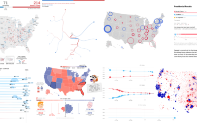
Alan McConchie from Stamen recaps the wide array of maps and charts that…
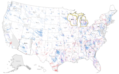
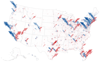
The Washington Post goes with a wind metaphor to show the change in…
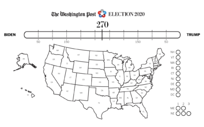
If you want to color in your own electoral map at home, The…
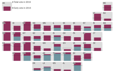
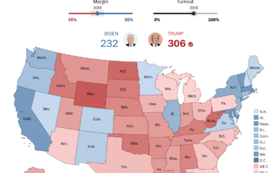
It’s election day here in the United States, but millions of votes have…
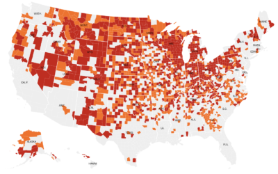
With this simple choropleth map, Lauren Leatherby for The New York Times shows…

Dots on a map can feel like, well, just a bunch of dots.…
The New York Times analyzed campaign finance data from April to October, mapping…
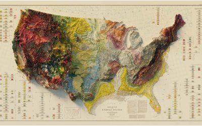
Muir Way updates vintage relief maps with a third dimension. Pretty. The above…
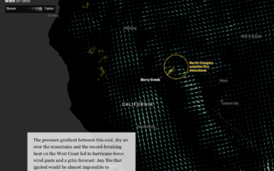
This is some advanced mapping and scrollytelling from the Washington Post. The piece…
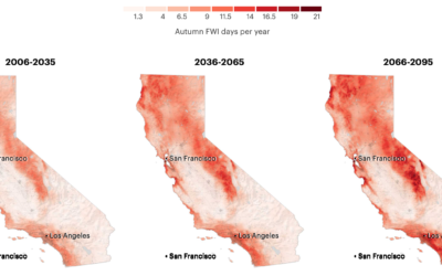
It’s been smoky this season. Based on research from Michael Goss et al.,…
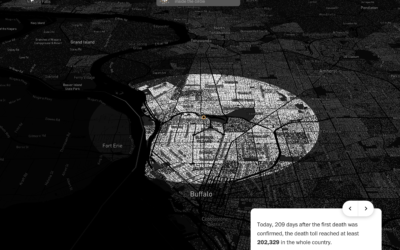
With recorded U.S. Covid-19 deaths passing the 200k mark, somehow the number still…
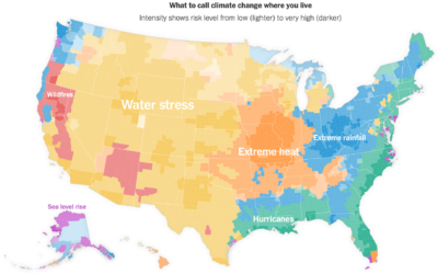
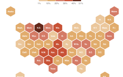
For NYT Opinion, Stuart A. Thompson and Yaryna Serkez mapped the most predominant…
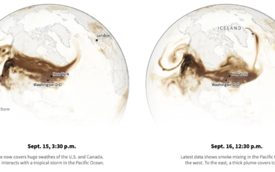
Smoke from the wildfires made its way to the other side of the…
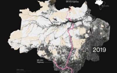
Bloomberg mapped tree loss between 2000 and 2019 in Brazil:
“What we have…
As we have seen, small shifts in voting behavior of various demographic groups…
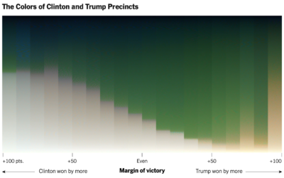
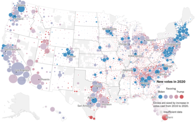
For NYT’s The Upshot, Tim Wallace and Krishna Karra looked at how the…
 Visualize This: The FlowingData Guide to Design, Visualization, and Statistics (2nd Edition)
New tools, refined process.


