For the NASA Earth Observatory, Adam Voiland describes about two decades of fires:…
NASA
-
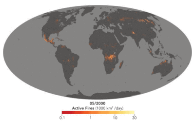
Map shows long-term record of fires around the world
-
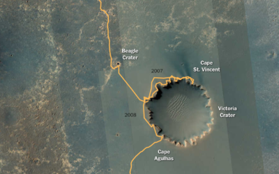
Opportunity rover’s path on Mars
After a most unforgiving dust storm on Mars, NASA ended the 14-year mission…
-
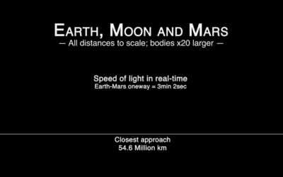
Real-time speed of light from Earth to Mars
Hurry up, light. We’re gonna be late:
By James O’Donoghue, the animation shows… -
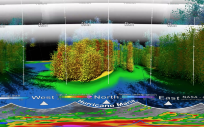
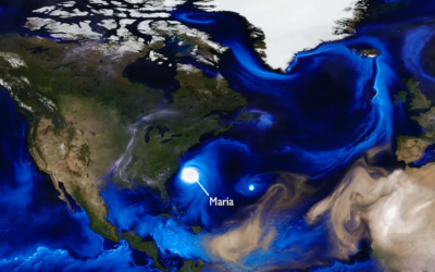
Inside Hurricane Maria, a 3-D perspective
This 3-D view inside Hurricane Maria, from NASA’s Scientific Visualization Studio and NASA’s…
-
World map shows aerosol billowing in the wind
Using a mathematical model based on satellite data, NASA shows an estimate of…
-
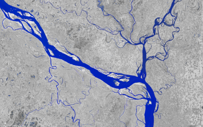
A transforming river seen from above
The Padma River in Bangladesh is constantly shifting its 75-mile path. Joshua Stevens…
-
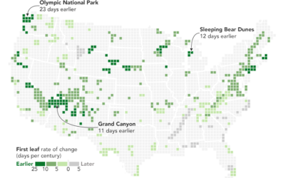
Maps show spring arriving earlier
From Joshua Stevens at the NASA Earth Observatory:
But over the longer term,… -
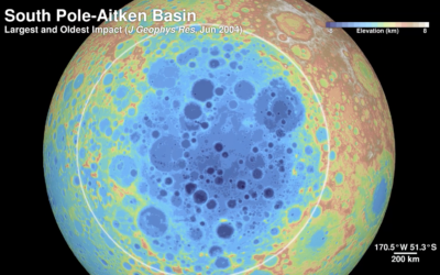
The Moon in 4k resolution
Based on data gathered by the Lunar Reconnaissance Orbiter, NASA pieced together this…
-
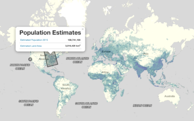
World population estimator and gridded data from NASA
Population data typically comes in the context of boundaries. City data. County data.…
-
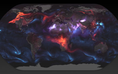
Simulation shows swirling of smoke, sea salt, and dust around the world
NASA. Data. Good.
Tracking the aerosols carried on the winds let scientists see… -
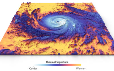
Thermal structure of Hurricane Maria
Hurricane Maria touched down in Puerto Rico. This visualization by Joshua Stevens at…
-
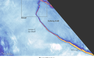
Detailed satellite view of iceberg break
Using the thermal signature, NASA provides a detailed view of the break:
The… -
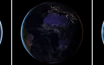
New images of Earth at night
NASA just released a composite map of the world at night using satellite…
-
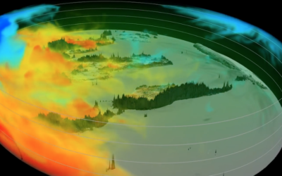
Following the carbon dioxide
This animated visualization from NASA Goddard Space Flight Center shows a model of…
-
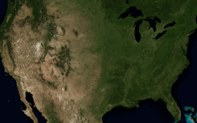
Mississippi drainage
Horace Mitchell for NASA’s Scientific Visualization Studio mapped the massive drainage basin that…
-
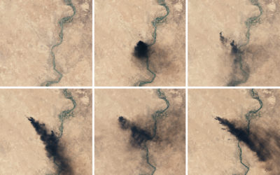
Oil fires in Iraq seen from above
Though far away, there’s still a lot you can see, as the NASA…
-
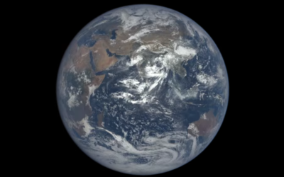
One-year time-lapse of Earth
Time-lapse from space by NASA:
On July 20, 2015, NASA released to the… -
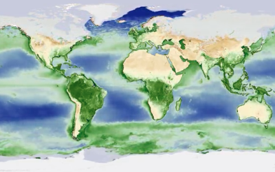
Plant life cycle shows a breathing Earth
NASA mapped the annual cycle of all plant life on the planet in…
-
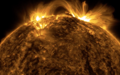
The Sun in ultra-HD
Daang, NASA. Using images of the sun taken in space, NASA constructed this…
-
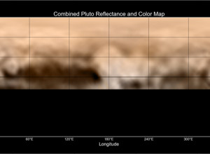
Pluto reflectance map: Whale and the Donut
Using images taken by New Horizons between June 27 and July 3, this…
Recently for Members
Second Edition
 Visualize This: The FlowingData Guide to Design, Visualization, and Statistics (2nd Edition)
 Visualize This: The FlowingData Guide to Design, Visualization, and Statistics (2nd Edition)
New tools, refined process.
Browse by Chart Type See All →


