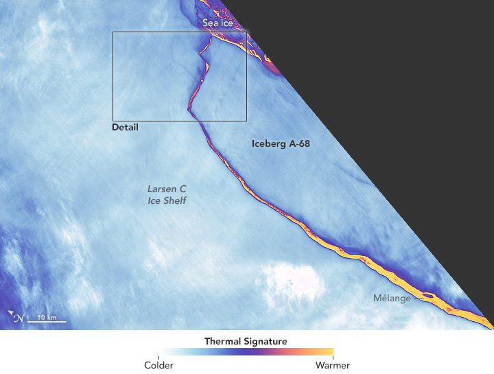
Using the thermal signature, NASA provides a detailed view of the break:
The false-color image was captured by Landsat’s Thermal Infrared Sensor (TIRS). It shows the relative warmth or coolness of the landscape. Orange indicates where the surface is the warmest, most notably the mélange between the new berg and the ice shelf. Light blues and whites are the coldest areas, including the ice shelf and the iceberg.
It’s like something out of a movie.
 Visualize This: The FlowingData Guide to Design, Visualization, and Statistics (2nd Edition)