Aaron Steckelberg and Tik Root for The Washington Post provide a visual guide…
wildfire
-

Visual guide for protecting your home from wildfire
-
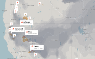
Tracking wildfires in the west
Wildfires continue to burn in the western United States. The New York Times…
-
Fires in the west and climate change
This is some advanced mapping and scrollytelling from the Washington Post. The piece…
-
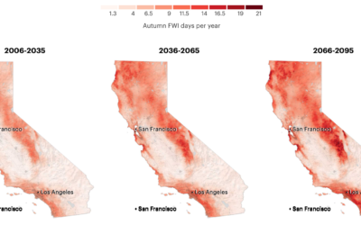
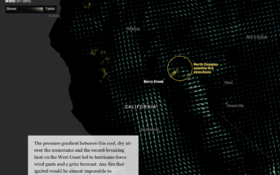
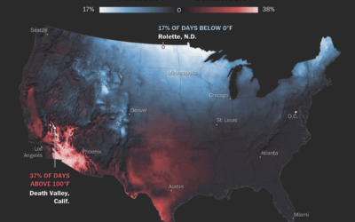
More fire weather days coming
It’s been smoky this season. Based on research from Michael Goss et al.,…
-

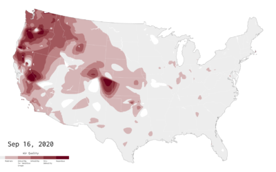
Millions of people experienced unhealthy air in 2020
NPR estimated how many people have experienced unhealthy air this year, largely in…
-
Air Quality Mapped Over Time
With wildfires burning in the western United States, smoke fills the air. This is an animation of the air quality during the past couple of months.
-
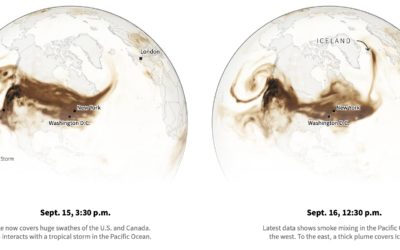
Smoke from the U.S. West Coast travels east and overseas
Smoke from the wildfires made its way to the other side of the…
-
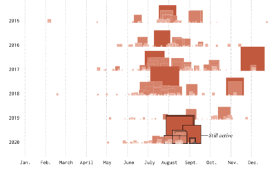
Timeline of California Wildfires
The wind was blowing smoke and ash from wildfires further up north from where I live. The sky turned an eerie orange. I wondered about past fires and made the chart below.
-
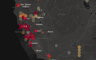
California wildfires map
Los Angeles Times provides a California-specific map of the current wildfires to stay…
-
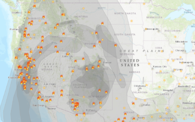
Fire and smoke map
With the rush of wildfires in California, governor Gavin Newsom declared (another) state…
-
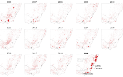
Where the Australia fires are burning
The New York Times zoomed in on southeastern Australia where the fires have…
-
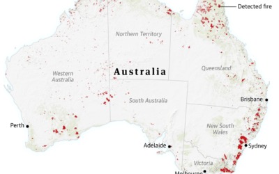
Visual guide for the fires in Australia
For The Guardian, Niko Kommenda and Josh Holder provide a visual guide to…
-
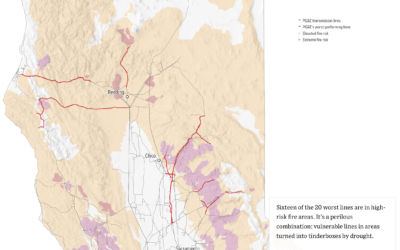
Worst performing circuits mapped with fire risk
This month PG&E has been shutting down power to thousands of households in…
-
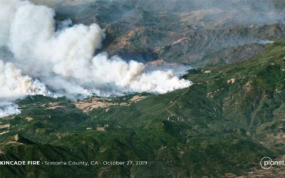
High-resolution satellite image of Kincade fire, up close from far away
I feel like satellite imagery has upped its skillset in recent years. According…
-
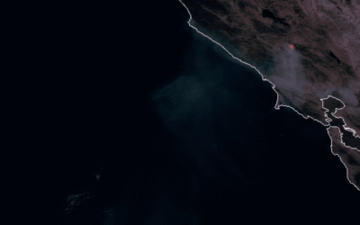
Kincade fire in Sonoma County via satellite imagery
You can see the time-lapsed imagery with this browser. [via @weatherdak]…
-
Maps of natural disasters and extreme weather
For The Washington Post, Tim Meko mapped floods, tornados, hurricanes, extreme temperatures, wildfires,…
-
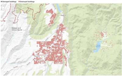
Where Camp fire destroyed homes
The Camp fire death toll rose to 63 and 631 missing as of…
Recently for Members
Second Edition
 Visualize This: The FlowingData Guide to Design, Visualization, and Statistics (2nd Edition)
 Visualize This: The FlowingData Guide to Design, Visualization, and Statistics (2nd Edition)
New tools, refined process.
Browse by Chart Type See All →


