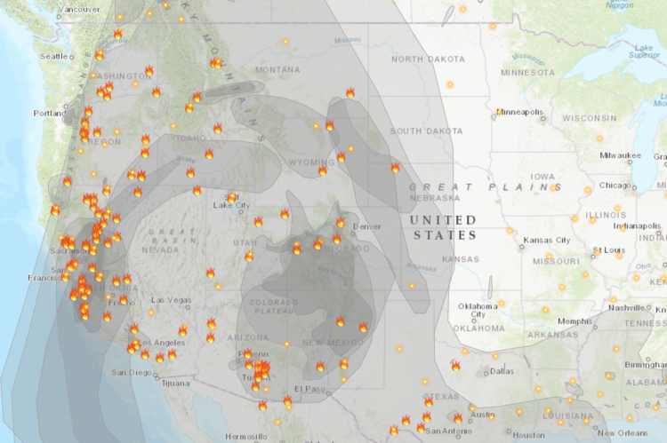
With the rush of wildfires in California, governor Gavin Newsom declared (another) state of emergency. The Fire and Smoke Map from the U.S. Forest Service and Environmental Protection Agency provides a picture of where we’re currently at. The map incorporates data from a variety of sensors across the country:
The sensor data comes from PurpleAir, which crowdsources data from that company’s particle pollution sensors and shows the data on a map. Before the sensor data appear on the AirNow Fire and Smoke Map, EPA and USFS apply both a scientific correction equation to mitigate bias in the sensor data, and the NowCast, the algorithm to show the data in the context of the Air Quality Index.
 Visualize This: The FlowingData Guide to Design, Visualization, and Statistics (2nd Edition)