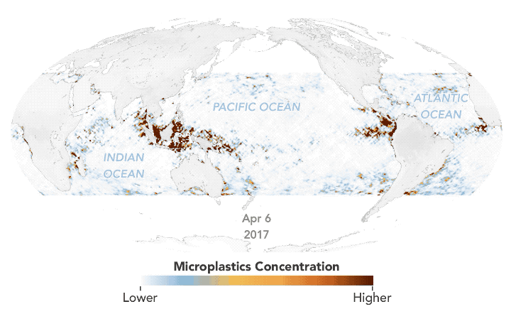
Using estimates based on satellite data, Joshua Stevens for NASA Earth Observatory mapped the concentration of microplastics in the ocean over time:
Researchers at the University of Michigan (UM) recently developed a new method to map the concentration of ocean microplastics around the world. The researchers used data from eight microsatellites that are part of the Cyclone Global Navigation Satellite System (CYGNSS) mission. Radio signals from GPS satellites reflect off the ocean surface, and CYGNSS satellites detect those reflections. Scientists then analyze the signals to measure the roughness of the ocean surface. These measurements provide scientists with a means to derive ocean wind speeds, which is useful for studying phenomena like hurricanes. It turns out that the signals also reveal the presence of plastic.
 Visualize This: The FlowingData Guide to Design, Visualization, and Statistics (2nd Edition)