Vaccination rates are still relatively high, but they need to be for herd…
Maps
Intuitive to look at spatial patterns and great for distributing geographic data.
-
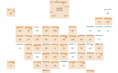
Falling below herd immunity
-
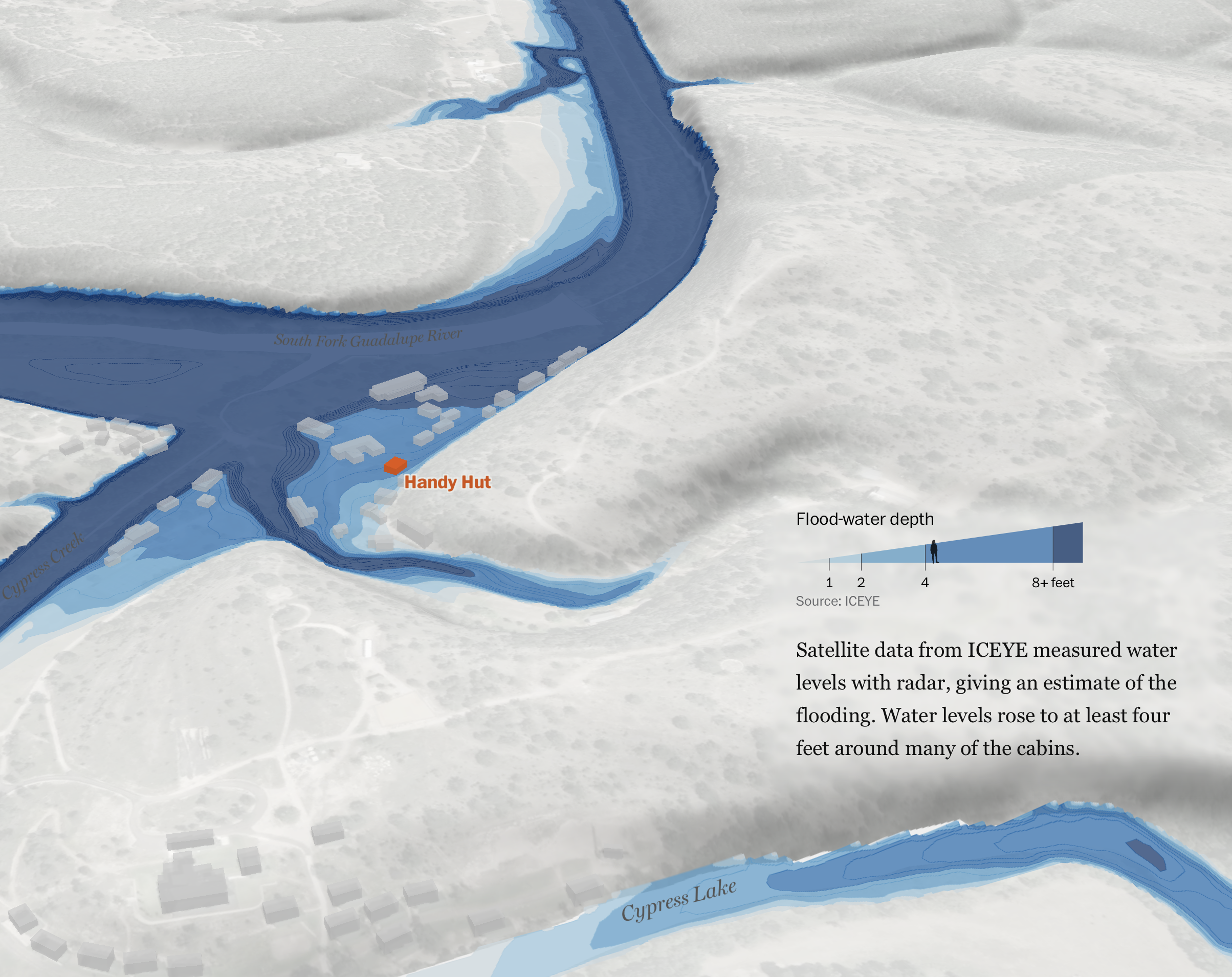
What happened at Camp Mystic
The Washington Post reconstructed the flooding at Camp Mystic, from the perspectives of…
-
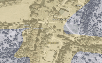
Map of flood-risk area at Camp Mystic
The New York Times mapped an overhead view of Camp Mystic with flood-risk…
-
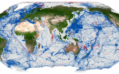
Quarter of the world’s ocean floor has been mapped, so far
The Seabed 2030 Project aims to create a complete map of the world’s…
-
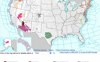
Map of alerts from the National Weather Service
We are seeing in real-time why the National Weather Service, a part of…
-
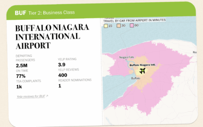
Rating all the U.S. airports
There are great airports and there are really bad ones. Which one you…
-
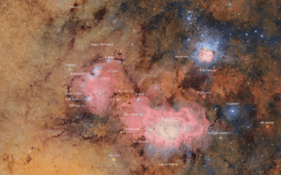
Rubin Observatory releases first imagery of the night sky at enormous scale
The Vera C. Rubin Observatory, jointly funded by the National Science Foundation and…
-
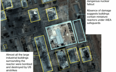
Satellite imagery shows avoided nuclear reactors in Iran
Jonathan Tirone, reporting for Bloomberg:
Notably absent from the latest International Atomic Energy… -
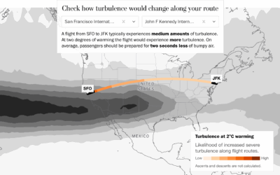
As temperatures rise, how much turbulence to expect on your flight
With temperatures rising, we must prepare for how everyday life could change, other…
-
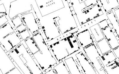
John Snow probably didn’t use that Broad Street map to reach his conclusions about cholera
Many visualization folks recognize the cholera map as a vital tool that John…
-
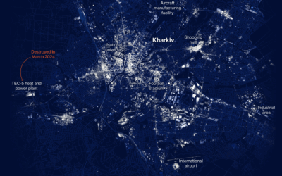
Fading lights in Ukraine mapped
Ukraine has suffered ongoing damage to their power infrastructure since the invasion began.…
-
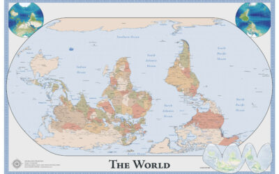
Map of an upside down world
While we’re on maps oriented in unfamiliar ways, Robert Simmon made an upside…
-
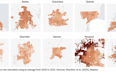
Sinking land in U.S. cities
Land is sinking, or subsiding, at a slow rate of millimeters per year.…
-
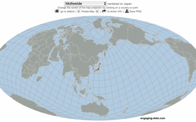
Center the map on the country you want
Speaking of maps centered on specific countries, Engaging Data made an interactive map…
-

World map with south on top and Brazil in center
The Brazilian Institute of Geography and Statistics (IBGE), Brazil’s agency for statistics and…
-
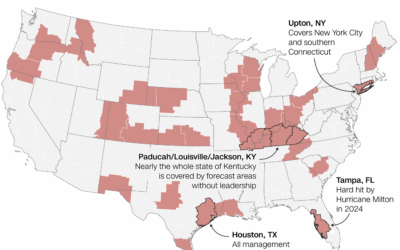
National weather forecasting in jeopardy
For CNN, Andrew Freedman reports:
Of the hundreds of vacancies, the 30 open… -
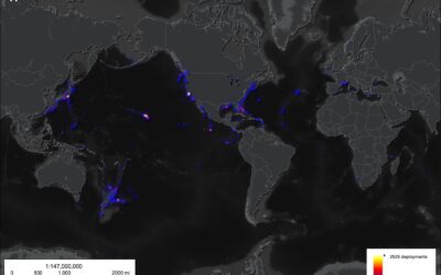
Limited surveying of the deep sea, a tiny 0.001%
Researchers from the Ocean Discovery League estimated how little we know about the…
-

Internet Roadtrip, where the community votes where to go at each step
What if you were on a roadtrip and every ten seconds a large…
Recently for Members
Second Edition
 Visualize This: The FlowingData Guide to Design, Visualization, and Statistics (2nd Edition)
 Visualize This: The FlowingData Guide to Design, Visualization, and Statistics (2nd Edition)
New tools, refined process.
Browse by Chart Type See All →


