A hundred bucks in one state doesn’t always get you the same thing…
Maps
Intuitive to look at spatial patterns and great for distributing geographic data.
-
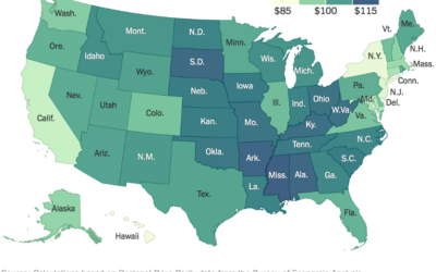
What $100 buys in each state
-

Dialect book of maps
In 2013, Josh Katz put together a dialect quiz that showed where people…
-
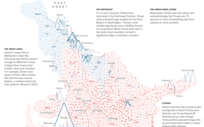
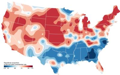
Peaks and valleys of presidential support
This is some fine map work by Lazaro Gamio and Dan Keating for…
-
All the ways to map election results
Every election, there’s a slew of election maps that come in all shapes…
-
Impact of Obamacare in maps
It’s been three years since the Affordable Health Care Act. Margot Sanger-Katz and…
-

Vintage cartography and geography documentary, from 1961
This is too good not to watch. It’s a 1961 documentary on cartography…
-
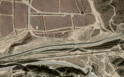
Visualizing the U.S.-Mexican border
There’s been a lot of talk about building a wall at the U.S.-Mexican…
-
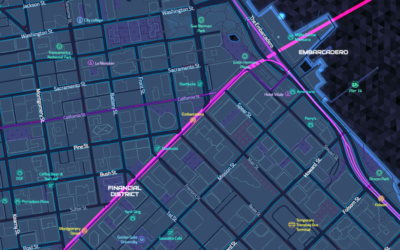
Tron-style slippy map
Mapzen just released a Tron-style slippy map.
Today we introduce TRON version 2… -
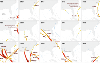
Century of Florida hurricanes
Florida has seen a lot of hurricanes come and go. Lazaro Gamio for…
-
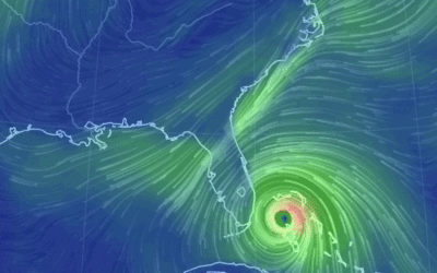
Hurricane Matthew en route
Stay safe, Florida.…
-
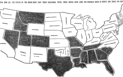
Map shows two-party presidential shifts since 1920
In an update to his two-party map, political scientist David Sparks shows the…
-
Mississippi drainage
Horace Mitchell for NASA’s Scientific Visualization Studio mapped the massive drainage basin that…
-
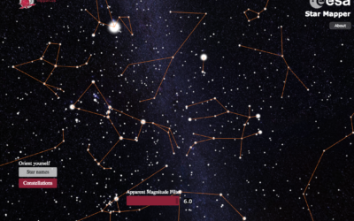
Explore the stars with this interactive Star Mapper
Jan Willem Tulp, in collaboration with the European Space Agency, produced the ESA…
-
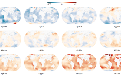
Oceans absorbing heat
It keeps getting hotter on this planet, and the oceans are absorbing most…
-
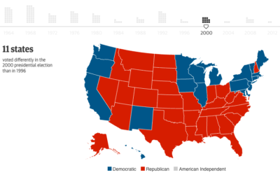
Swing states are a relatively new thing
Here’s a fun one from the Guardian. They go over the change in…
-
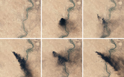
Oil fires in Iraq seen from above
Though far away, there’s still a lot you can see, as the NASA…
-
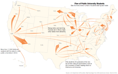
Out of state, public education
Nick Strayer for the New York Times shows the flow of college freshman…
-
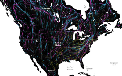
Animal migrations in animated map
The Migrations in Motion map, by Dan Majka from the The Nature Conservancy,…
Recently for Members
Second Edition
 Visualize This: The FlowingData Guide to Design, Visualization, and Statistics (2nd Edition)
 Visualize This: The FlowingData Guide to Design, Visualization, and Statistics (2nd Edition)
New tools, refined process.
Browse by Chart Type See All →


