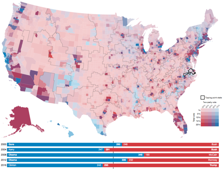
Geography and state borders play a big part in how elections play out and where candidates campaign. Neil Freeman demonstrates with a map that generates random state boundaries.
This interactive map creates randomly-generated state boundaries for the United States, and see who would recent presidential elections under the map. Under different combinations of states, different regions become the deciding factor, and even broad popular support can be overturned by the specific state boundaries.
I think to really drive the point home, Freeman could highlight the elections that shift in final result instead of relying on just the 270 mark.
Update: Freeman applied the method to boundaries formed by various aspects of our lives.


 Visualize This: The FlowingData Guide to Design, Visualization, and Statistics (2nd Edition)
