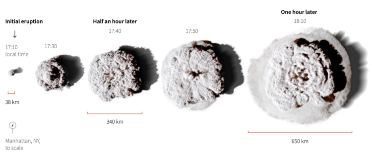
Manas Sharma and Simon Scarr used satellite imagery to show the scale of the Tonga eruption, which spurted a 24-mile cloud that grew to 400 miles in diameter in an hour. Notice the little Manhattan in the bottom left corner in the image above.
However, instead of leaving it at that, Sharma and Scarr animated the eruption over familiar geographic areas to better see how big it was. The cloud was big enough to cover whole countries.
 In an automated job climate that analyzes resumes and inspects social profiles, it can be a challenge to find the job that’s right for you. Luckily, Jess Peter for The Pudding put together a




 Visualize This: The FlowingData Guide to Design, Visualization, and Statistics (2nd Edition)