The New York Public Library announced open access to 20,000 maps, making them…
Maps
Intuitive to look at spatial patterns and great for distributing geographic data.
-
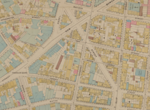
Open access to 20,000 maps from NYPL
-

Planetary layer cake
From Cakecrumbs, a product that helps you learn while you eat: planetary layer…
-
Centuries of European border changes
The Centennia Historical Atlas is a program that shows you border changes in…
-
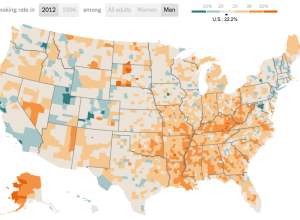
Smoking rates and income →
Based on a study on smoking prevalence from 1996 to 2012, a map…
-
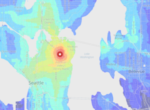
Reconstructing Google Streetview as a point cloud
Patricio Gonzalez Vivo, an MFA Design & Technology student, scraped depth from Google…
-
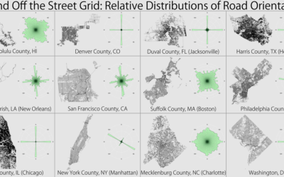
Level of road grid
Seth Kadish looked at the road network of several major counties and estimated…
-
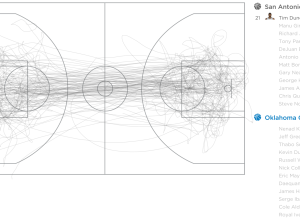
Basketball movements visualized
The NBA has been kind of gaga over data the past few years,…
-
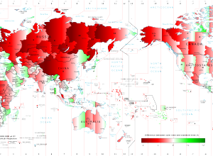
Solar time versus standard time around the world
After noting the later dinner time in Spain, Stefano Maggiolo noted relatively late…
-
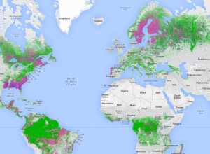
Near-real-time global forest watch
Global Forest Watch uses satellite imagery and other technologies to estimate forest usage,…
-
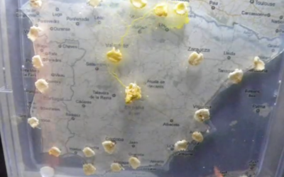
Using slime mold to find the best motorway routes
This is all sorts of neat. Researchers Andrew Adamatzky and Ramon Alonso-Sanz are…
-
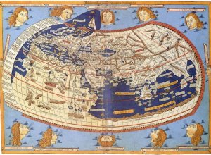
Why we think of north pointing up
Nick Danforth for Al Jazeera delves into the history books for why north…
-
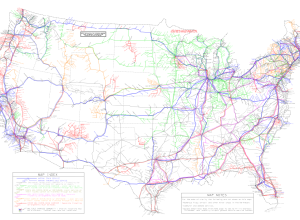
Map: US bus and Amtrak routes
In case you’re wondering how to travel the country without a car (in…
-
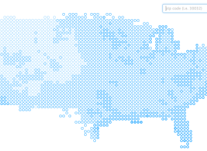
Places in the US with the most pleasant days per year
We’ve seen plenty of maps the past few weeks that show how bad…
-
Digitally revamped atlas of historical geography, from 1932
In 1932, Charles O. Paullin and John K. Wright published Atlas of the…
-
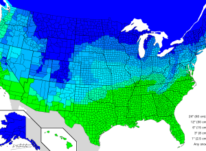
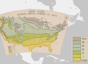
Amount of snow to cancel school
Someone ended an email to me last week with “Stay warm.” Not to…
-
Public transit times in major cities
Last year, WNYC made an interactive map that shows transit times in New…
-
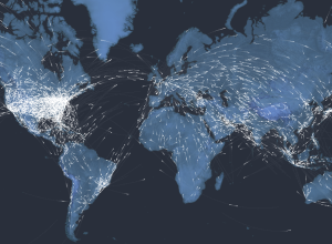
A century of passenger air travel →
Kiln and the Guardian explored the 100-year history of passenger air travel, and…
-
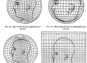
Map projections illustrated with a face
Most people, at least those who visit sites like FlowingData, know about map…
Recently for Members
Second Edition
 Visualize This: The FlowingData Guide to Design, Visualization, and Statistics (2nd Edition)
 Visualize This: The FlowingData Guide to Design, Visualization, and Statistics (2nd Edition)
New tools, refined process.
Browse by Chart Type See All →


