With latitude and longitude coordinates, there are a number of ways to map geographic data using D3.js and Leaflet.
Leaflet
-
Members Only
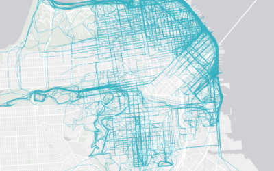
How to Make an Interactive Map of Geographic Paths
-
Link
Crosslet
Crosslet is “a free small (22k without dependencies) JavaScript widget for interactive visualisation and analysis of geostatistical datasets.” It’s a combination of Crossfilter, Leaflet, and D3.
Recently for Members
Second Edition
 Visualize This: The FlowingData Guide to Design, Visualization, and Statistics (2nd Edition)
 Visualize This: The FlowingData Guide to Design, Visualization, and Statistics (2nd Edition)
New tools, refined process.
Browse by Chart Type See All →


