I heard you like maps. Jim Vallandingham put together a collection of maps…
Maps
Intuitive to look at spatial patterns and great for distributing geographic data.
-
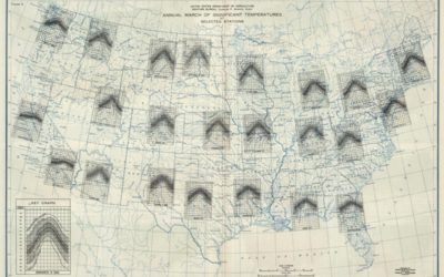
Multivariate map collection
-
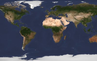
Simulation shows swirling of smoke, sea salt, and dust around the world
NASA. Data. Good.
Tracking the aerosols carried on the winds let scientists see… -
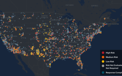
Bomb contaminants where you live
Lena Groeger, Ryann Grochowski Jones and Abrahm Lustgarten, reporting for ProPublica with a…
-
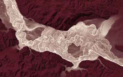
High-detail landscape using lidar data
Lidar, which is like radar but with lasers instead of radio waves, can…
-
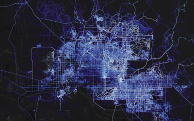
Global cycling and running heatmap
A few years back, cycling and running app Strava mapped the paths of…
-
A daily high-resolution image of Earth
Planet monitors Earth with hundreds of satellites, and after six years, they’ve built…
-
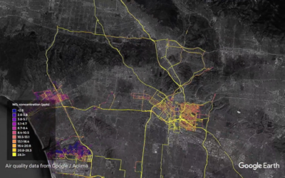
Google maps street-level air quality using Street View cars with sensors
Google equipped their Street View cars with air quality sensors and sent them…
-
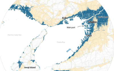
Cities projected to be under water by 2100
Using Climate Central sea-level rise estimates, The Guardian plots and maps the potential…
-
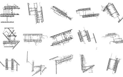
A study of the geographic forms in cartography
Cartographer Geraldine Sarmiento from Mapzen explores the drawing forms in cartography, such as…
-
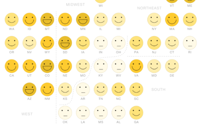
Mapping happiness
Gallup surveyed Americans about their well-being across various factors. National Geographic gets into…
-
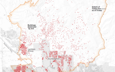
Map of Santa Rosa fires
Using both satellite images and ground surveys, The New York Times maps the…
-
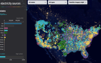
US electricity sources map
This interactive map from CarbonBrief shows how America generates electricity. Each circle represents…
-
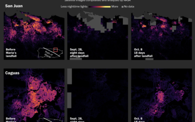
Darkness mapped in Puerto Rico
Three weeks in, much of Puerto Rico is still without power. Denise Lu…
-

Grid map variations
Grid maps are a useful way to show state-level data, as they give…
-
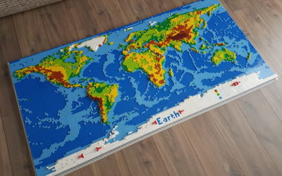
LEGO world map
Check out this five-foot long LEGO world map.
[W]e wanted to have a… -
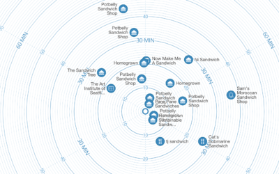
Time map shows locations based on how long it takes to get there
With the premise that we often search for locations based on how long…
-
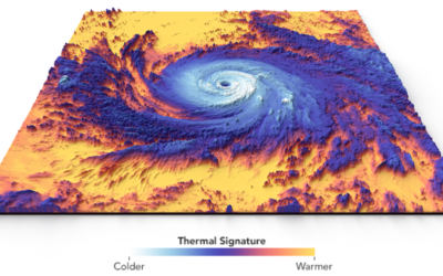
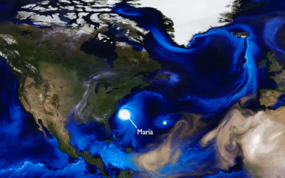
Thermal structure of Hurricane Maria
Hurricane Maria touched down in Puerto Rico. This visualization by Joshua Stevens at…
-
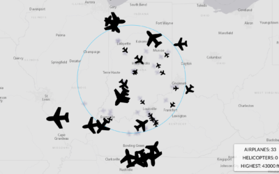
Aviation tracker with depth
I’ve grown bored of maps that show commuter traffic, but for whatever reason,…
Recently for Members
Second Edition
 Visualize This: The FlowingData Guide to Design, Visualization, and Statistics (2nd Edition)
 Visualize This: The FlowingData Guide to Design, Visualization, and Statistics (2nd Edition)
New tools, refined process.
Browse by Chart Type See All →


