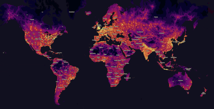
From The Malaria Atlas Project, a global map of estimated accessibility to cities:
In the present study, we quantify and validate global accessibility to high-density urban centres at a resolution of 1×1 kilometre for 2015, as measured by travel time. The last global mapping effort to measure accessibility was for the year 2000, a time that predates both substantial investment and expansion of transportation infrastructure and an extraordinary improvement in the data quantity and quality of accessibility measures. The game-changing improvement underpinning this work is the first-ever, global-scale synthesis of two leading roads datasets – Open Street Map (OSM) data and distance-to-roads data derived from the Google roads database – which resulted in a nearly five-fold increase in the mapped road area relative to that used to produce the circa 2000 map.
The dark areas are the most fascinating.
 Visualize This: The FlowingData Guide to Design, Visualization, and Statistics (2nd Edition)