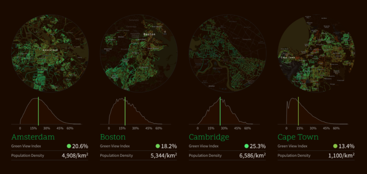
Treepedia, from the MIT Senseable City Lab, estimates perceived tree cover at the street level. They used panorama views from Google Street View to form a “Green View Index”, which they then mapped for major cities.
Treepedia measures the canopy cover in cities. Rather than count the individual number of trees, we’ve developed a scaleable and universally applicable method by analyzing the amount of green perceived while walking down the street. The visualization maps street-level perception only, so your favorite parks aren’t included! Presented here is preliminary selection of global cities.

 Visualize This: The FlowingData Guide to Design, Visualization, and Statistics (2nd Edition)