Drawing inspiration from early cartographers who had to make maps with limited information,…
mapping
-

Testing views of Earth through an LLM’s internals
-
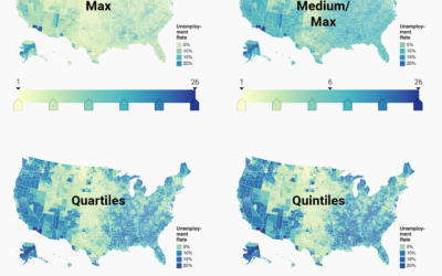
Choosing color palettes for choropleth maps
Choropleth maps, the ones where regions are filled with colors based on data,…
-
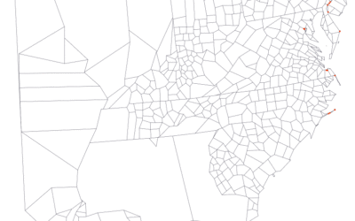
Adjusting map data with Mapshaper
Map making is a finicky challenge where oftentimes your map data — points,…
-
Link
d3.geo.statePlanes →
Nice projections for US states in D3.
-
GeoCommons 2.0, now with more mapping features
GeoCommons, an open repository of data and maps, launched version 2.0 this week,…
Recently for Members
Second Edition
 Visualize This: The FlowingData Guide to Design, Visualization, and Statistics (2nd Edition)
 Visualize This: The FlowingData Guide to Design, Visualization, and Statistics (2nd Edition)
New tools, refined process.
Browse by Chart Type See All →


