Palisades fire, seen from above
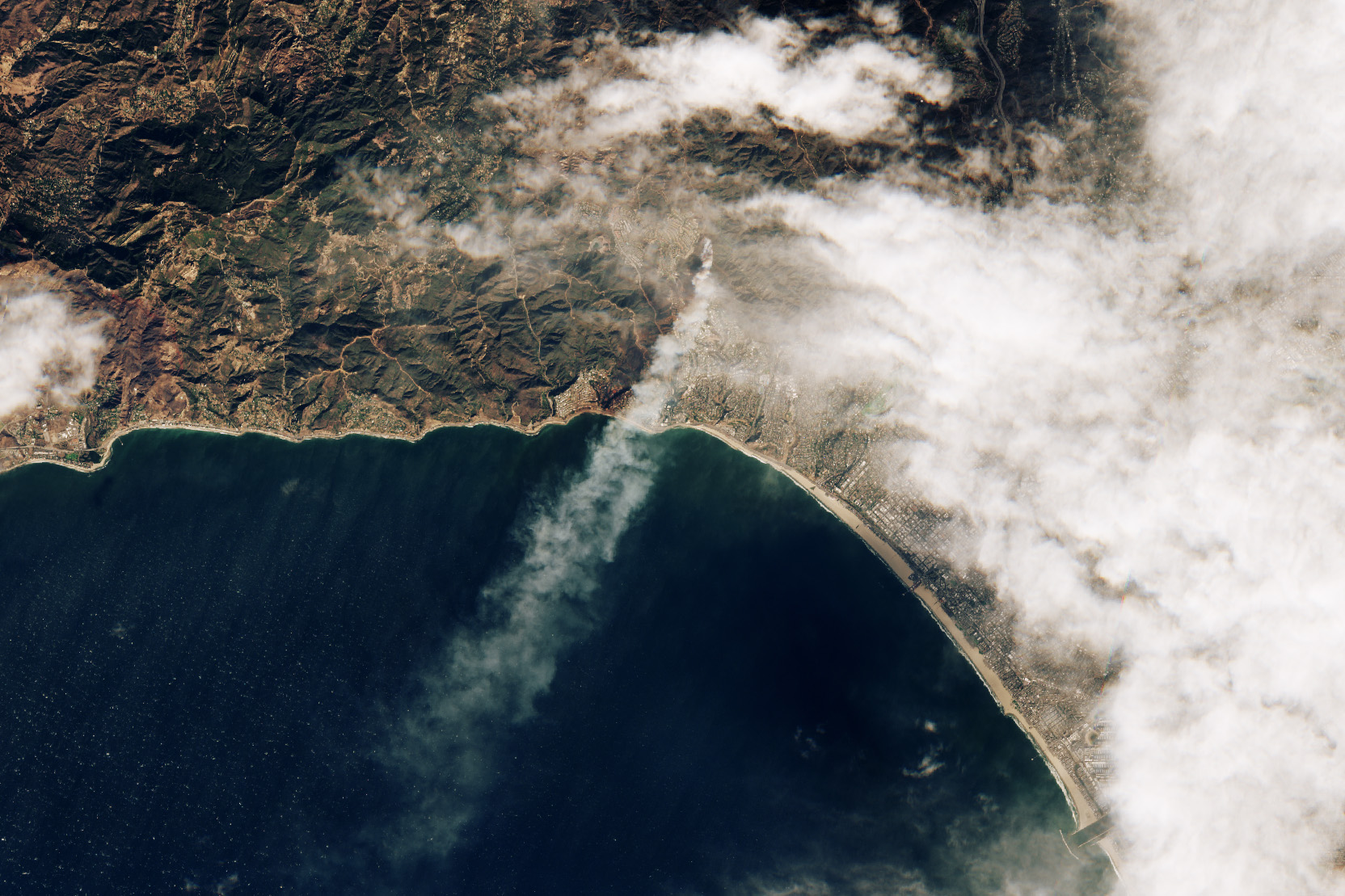
Sentinel-2 satellite of the European Space Agency captured an image of the Palisades fire when it began:
One of the wind-driven fires ignited during the morning of January 7, near the Pacific Palisades neighborhood. The image below, acquired by the European Space Agency’s Sentinel-2 satellite, shows the Palisades fire at 10:45 a.m. Pacific Time on January 7, soon after it ignited.
The Palisades is that area along the coast, right next to the narrow smoke plume in the middle.
Become a member. Support an independent site. Get extra visualization goodness.
See What You Get