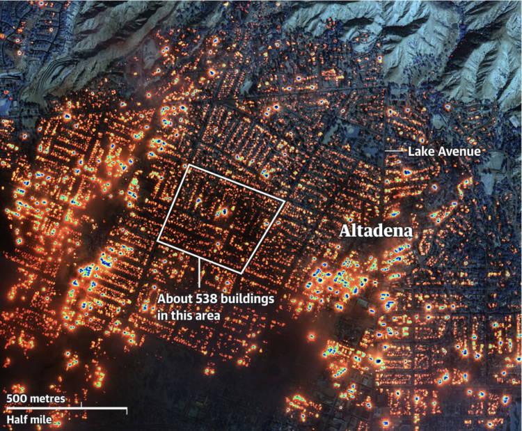
The Guardian provides a visual guide to the damage in Los Angeles with a combination of maps, photos, and video, categorized by location (Altadena, Pacific Palisades, and Malibu).
The underlying image in the above is a composite of infrared satellite imagery by Maxar. It is a lot.
 Visualize This: The FlowingData Guide to Design, Visualization, and Statistics (2nd Edition)