Can be integrated in a number of ways
Links
-
Link
R in client applications →
-
Link
Mistakes and Phantom Blocks →
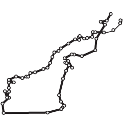
Geographic inconsistencies in iconic New York subway map
-
Link
What Cartography Taught Me about Science Writing →
Keep on whittling until you get to the storyline
-
Link
No such thing as too much data →
I’m sure there’s a breaking point, but we’re not there yet. Not even close.
-
Link
Selected Tools →
Good list of software for maps, charts, and ata
-
Link
R is not enough for Big Data →
Tools are just that, experience is most valuable [via]
-
Link
Federal Spending Transparency on the Decline →
Questionable data quality and less funding
-
Link
Pretty pictures: Can images stop data overload? →
“The results showed that when tasks were presented visually rather than using traditional text-based software applications, individuals used around 20% less cognitive resources.”
-
Link
Mapmaking checklist for map design →
To evaluate how good maps are
-
Link
From Tiny Links, Big Insights →
Profile of chief bitly scientist Hilary Mason, data hacker at large
-
Link
US health care spending →
Simple graphs in R but effective
-
Link
How to Muddy Your Tracks on the Internet →
There’s a lot of tracking as your browse the net, and here’s how to limit the bits of you data you put out there
-
Link
Histogrem →
Font to put histograms in your text files
-
Link
Axes in D3 →
Tutorial on built-in formatting
-
Link
Bit rot →
The slow decay of digital content, and as a result, history
-
Link
Growth of the Data Scientist →
Short interview with Hilary Mason
-
Link
Visualization round table →
Discussing data and online journalism
-
Link
How to lie with smoking statistics →
Author of “How to Lie with Statistics” was a consultant to the tabacco industry
-
Link
Titanic infographics from 1912 →
Fourth one is the best, shows travel times to cross the Atlantic
-
Link
A Very Short History of Data Science →
Collection of notable articles on the budding field in chronological order, beginning in 1974

 Visualize This: The FlowingData Guide to Design, Visualization, and Statistics (2nd Edition)


