SimCity-like views using satellite imagery
Mar 30, 2018

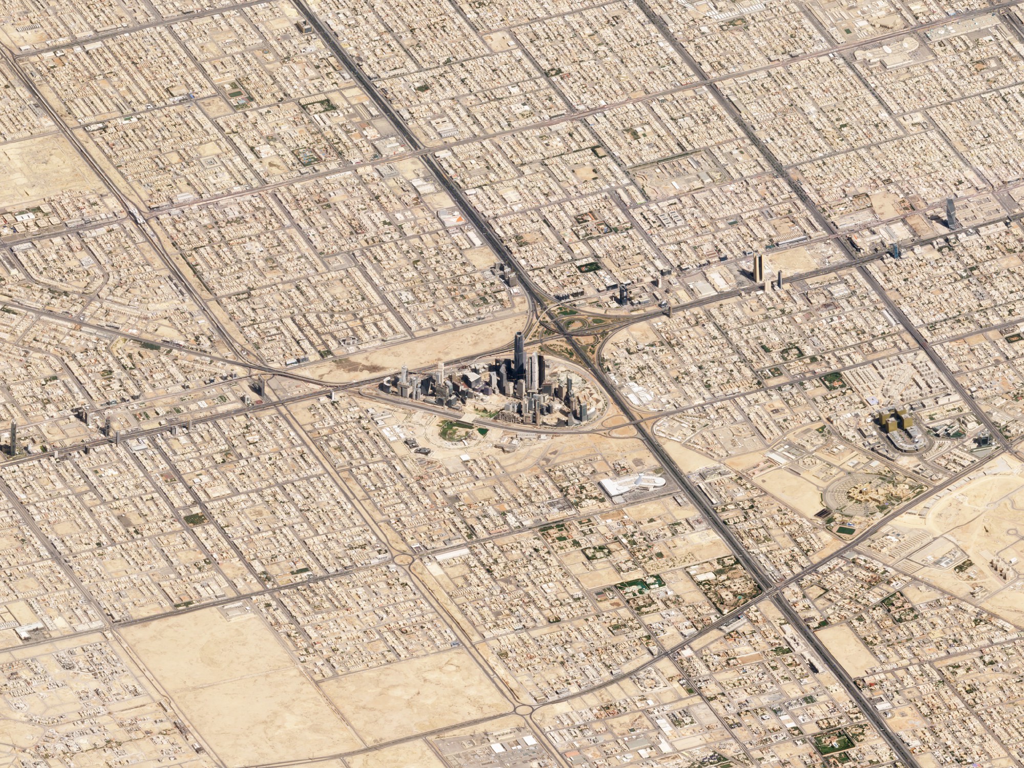
Maps typically show a view from straight above, which is good for navigation and to see regional patterns over large areas. However, missing out on the extra dimension of height can mean missing out on context. Robert Simmon for Planet Labs shows off some work in getting the less abstract perspective at a large scale.

Become a member. Support an independent site. Make great charts.

See What You Get

Favorites

Who We Spend Time with as We Get Older

In high school, we spend most of our days with friends and immediate family. But then we get jobs, start a family, retire, and there’s a shift in who we spend our days with.

The Most Unisex Names in US History

Moving on from the most trendy names in US history, …

Marrying Age

People get married at various ages, but there are definite trends that vary across demographic groups. What do these trends look like?

When Americans Reach $100k in Savings

It was reported that 1 in 6 millennials have at least $100,000 saved. Is this right? It seems high. I looked at the data to find out and then at all of the age groups.