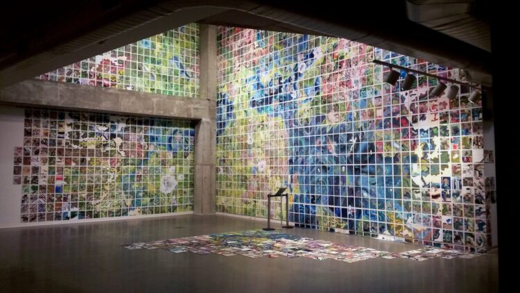
Jerry Gretzinger started a map of a fictional city in 1963 with eight by ten-inch panels. Then he just kept going, took a break for a couple decades, and then resumed the work.
Years later, the Map is now a two-dimensional “virtual world” art project which is now comprised of over 4000 individual eight by ten inch panels. When assembled, these panels form an approximate circle. The panel locations are defined by N, S, E, and W coordinates that originate at the center of the circle. The locations in the matrix do not change, but the panels themselves are continually revised based on instructions drawn from the artist’s custom deck of cards.
Its execution, in acrylic, marker, colored pencil, ink, collage, and inkjet print on heavy paper, is dictated by the interplay between an elaborate set of rules and randomly generated instructions.
I love these kind of long-term, hand-crafted projects. I’m wondering what a visualization equivalent would be using real data.
[via Waxy]
 Visualize This: The FlowingData Guide to Design, Visualization, and Statistics (2nd Edition)