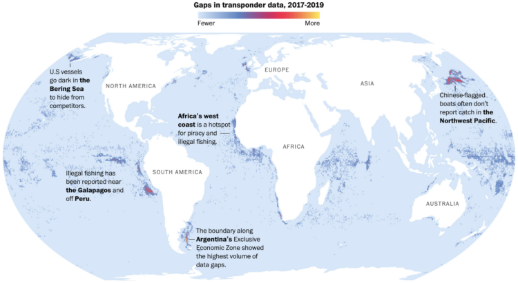
Speaking of non-location in the seas, researchers at the University of California at Santa Cruz, NOAA Fisheries, and Global Fishing Watch are trying to use the absence of data to identify boats fishing illegally. Harry Stevens for The Washington Post has the maps showing when fishermen turned off their transponders to hide location.
There’s plenty of (missing) data, but the tricky part is figuring out if the shutoffs are during illegal activities or are just fishermen keeping their spots private from competitors and pirates. [Thanks, Michael]


 Visualize This: The FlowingData Guide to Design, Visualization, and Statistics (2nd Edition)
