
Global Fishing Watch is an initiative to place some accountability on global fishing, an activity typically a challenge to track.
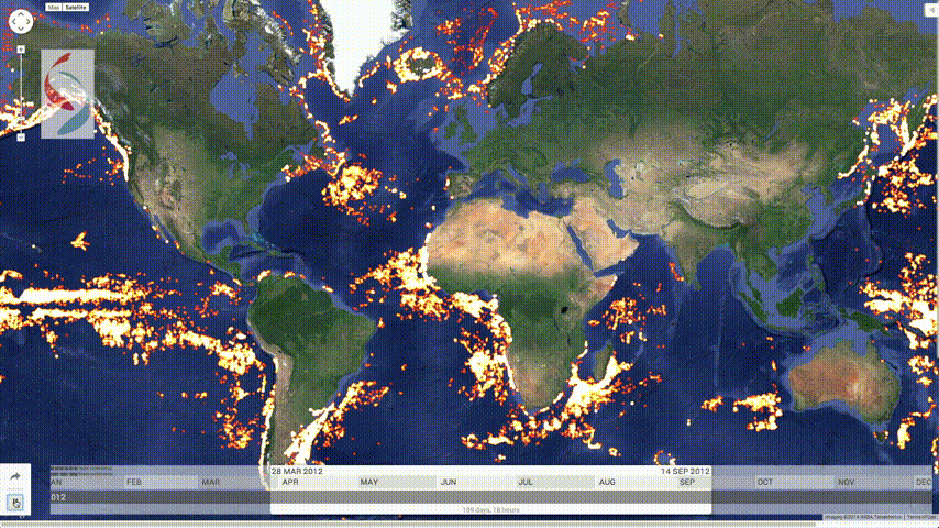
This version of the Global Fishing Watch started with 3.7 billion data points, more than a terabyte of data from two years of satellite collection, covering the movements of 111,374 vessels during 2012 and 2013. We ran a behavioral classification model that we developed across this data set to identify when and where fishing behavior occurred. The prototype visualization contains 300 million AIS data points covering over 25,000 unique vessels. For the initial fishing activity map, the data is limited to 35 million detections from 3,125 vessels that we were able to independently verify were fishing vessels. Global Fishing Watch then displays fishing effort in terms of the number of hours each vessel spent engaged in fishing behavior, and puts it all on a map that anyone with a web browser will be able to explore.
The map below is an example of the fishing patterns over time.
A good start. I hope they can make estimates of legal and illegal activity in the next iteration.
 Visualize This: The FlowingData Guide to Design, Visualization, and Statistics (2nd Edition)