Snow cover mapped using snowflakes
Jan 17, 2023

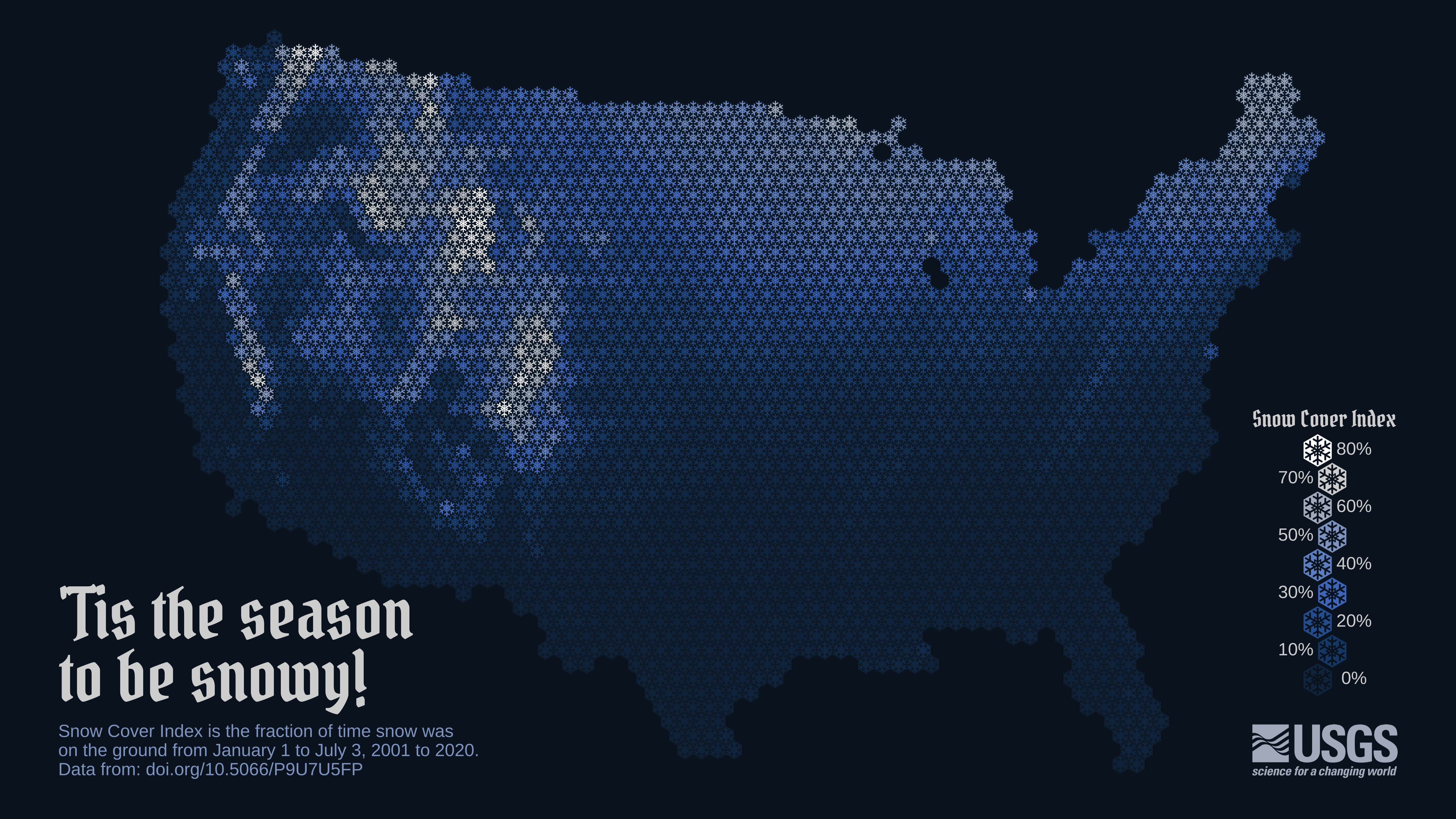
To show snow cover across the United States, Althea Archer for the USGS used hexbins, but instead of hexbins, she used snowflakes. Archer provided her R code and outlined her process in a blog post, which is something I’m not used to seeing from a government agency. I like it.

Become a member. Support an independent site. Make great charts.

See What You Get

Favorites

How to Spot Visualization Lies

Many charts don’t tell the truth. This is a simple guide to spotting them.

Sleep Schedule, From the Inconsistent Teenage Years to Retirement

From the teenage years to college to adulthood through retirement, sleep is all over the place at first but then converges towards consistency.

The Best Data Visualization Projects of 2014

It’s always tough to pick my favorite visualization projects. Nevertheless, I gave it a go.

One Dataset, Visualized 25 Ways

“Let the data speak” they say. But what happens when the data rambles on and on?