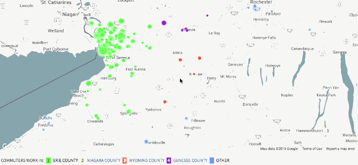
With an animated take on the commute map, Mark Evans shows where people commute to work.
The resulting animations are somewhat hypnotic (even my dog seemed to go into a trance watching them leading to minutes of human amusement) but also provide a visual way of quickly seeing the distribution of workers into a given city. The points are sized based on the number of commuters, so a large dot indicates a higher relative number of commuters moving from the same tract to the same tract. The dots are also color coded to see which counties are most represented in the commuter sample.
Just select a county to see. [Thanks, @Mikey_Two]
 Visualize This: The FlowingData Guide to Design, Visualization, and Statistics (2nd Edition)