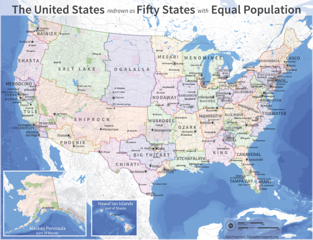
Neil Freeman reimagined state boundary lines based on population. He started with an algorithm and the fifty largest cities, considered proximity, urban area, and commuting patterns, and then hand-tweaked boundary lines and shapes. The state names are mostly centered around geographic features (although I would have opted for ones based on dating profiles).
“Keep in mind that this is an art project, not a serious proposal, so take it easy with the emails about the sacred soil of Texas.” [via kottke | Thanks, Mickey]
 Visualize This: The FlowingData Guide to Design, Visualization, and Statistics (2nd Edition)
I grew up in Minnesota without ever hearing the name ‘Mesabi’, and as far as I know the term ‘Iron Range’ would be the better known term throughout the state, including usage in newspapers. I would wager that if name choices were determined by popular vote, ‘Itasca’, source of the Mississippi River, would carry present-day Minnesota and its new fringes.
Digging the names on these.