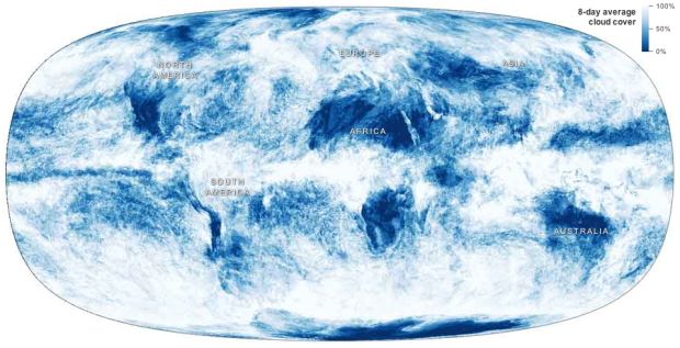
Jonathan Corum for the New York Times mapped cloud coverage from April 2011 to April 2012.
At any moment, about 60 percent of the earth is covered by clouds, which have a huge influence on the climate. An animated map showing a year of cloud cover suggests the outlines of continents because land and ocean features influence cloud patterns.
So if I’m understanding it right, the continent boundaries come straight from the cloud data, provided by NASA Earth Observations. No lines are drawn underneath, which is kinda awesome. [via @datapointed]
 Visualize This: The FlowingData Guide to Design, Visualization, and Statistics (2nd Edition)
Hmm. If you press play, it sure looks like the continents are drawn in dark blue underneath the clouds. Maybe the clouds do travel around the continents in certain ways, but they also seem to just be absent in desert areas.
I might be able to believe that southern Africa is define only by clouds, but there’s no way the Red Sea causes such a drastic interruption. I’m calling shenanigans.