The administration is pushing policies to open public land, some 59 million acres of national forest, for road construction and drilling. For Reuters, Ally Levine, Soumya Karmwa, and Travis Hartman mapped and charted current usage and management, emphasizing the importance of these protected areas.
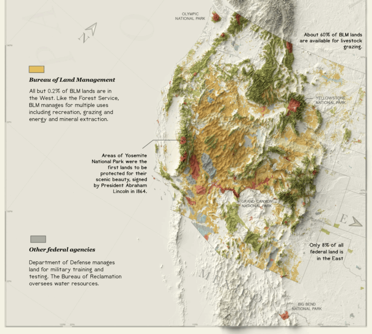
Public lands have balanced a variety of uses from drilling for oil and gas, mining for various minerals and logging to conservation and recreation. Each use is meant to serve the public good. But as the U.S. government has changed over time, what it considers “good” also has changed.
They went with the 1800s statistical atlas aesthetic and maps a la Reinhard, which I full-heartedly support. Bonus points for the water lines in the Sankey diagram.