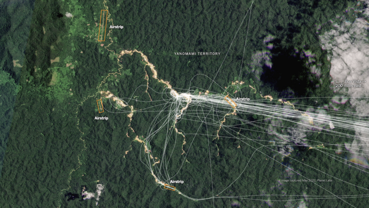
Using a combination of satellite imagery, crowdsourced databases, and analyses, The New York Times identified airstrips used for illegal mining in Brazil:
To confirm these locations and connect them with illicit mining, Times reporters built a tool to help analyze thousands of satellite images. They examined historical satellite imagery to determine that 1,269 unregistered airstrips still appeared in active use within the past year. They documented telltale signs of mining nearby, such as clear cut areas of rainforest and pools that miners use to separate dirt from ore. And they determined that hundreds of the airstrips in mining areas are within Indigenous and protected lands, where any form of mining is against the law.
 Visualize This: The FlowingData Guide to Design, Visualization, and Statistics (2nd Edition)