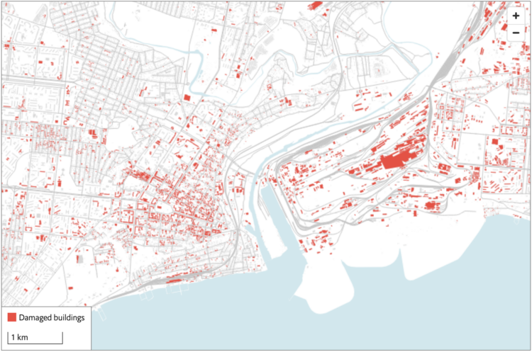
The Economist combined two satellite imagery sources, one that estimates fire events and one that estimates building damage, to assess the extent of damage in Ukraine:
Both approaches have weaknesses. NASA’s firms cannot see through cloud cover, a particular problem in winter. sar can pick up damage even through clouds, but is much less sensitive to changes outside of urban areas. But by combining the two datasets, we can form a fuller picture of the war. Our study shows that rather than being limited to a few big offensives and grinding battles, the war has left a brutal mark on large swathes of Ukraine. Fighting has reached 14% of municipalities, and damaged nearly half the built-up area in the hardest-hit cities.


 Visualize This: The FlowingData Guide to Design, Visualization, and Statistics (2nd Edition)
