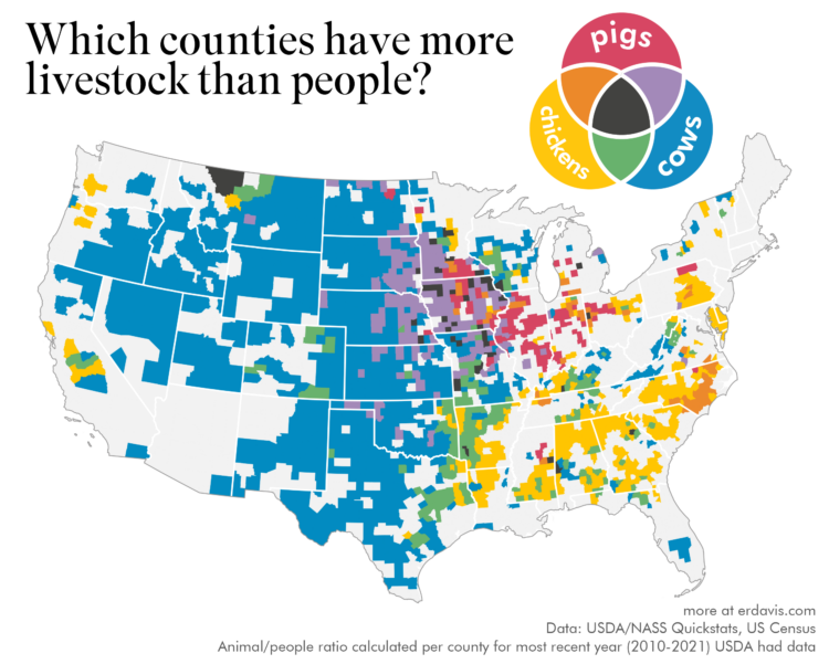
The United States Department of Agriculture provides annual inventory data on livestock, crops, and various products. The tool is very ad hoc government-looking, but it seems to work well enough.
Erin Davis made some fun maps that use the data at the county level to compare livestock populations to people populations. Davis compared animals individually, but the multivariate one that compares cows, chickens, and pigs is my favorite.


